Attalla elevation
Attalla (Alabama, Etowah County), United States elevation is 165 meters and Attalla elevation in feet is 541 ft above sea level [src 1]. Attalla is a populated place (feature code) with elevation that is 114 meters (374 ft) smaller than average city elevation in United States.
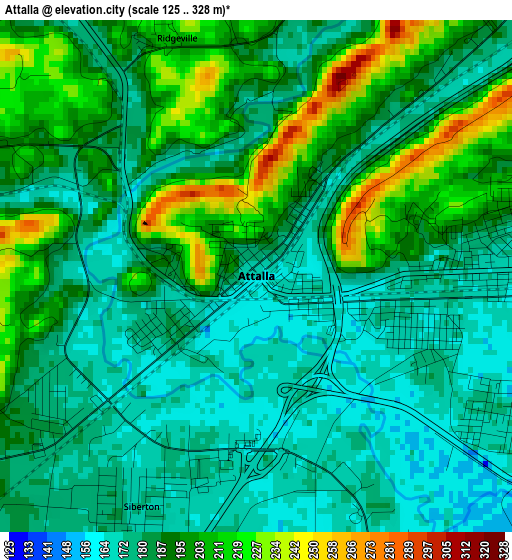
Below is the Elevation map of Attalla, which displays elevation range with different colors. Scale of the first map is from 125 to 328 m (410 to 1076 ft) with average elevation of 188.1 meters (=617 ft) [note 1]
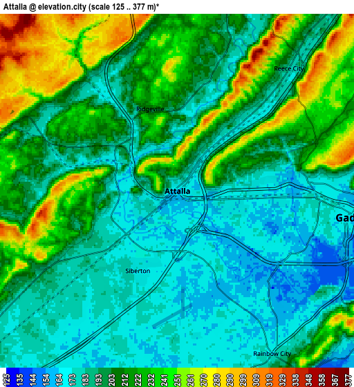
These maps also provides idea of topography and contour of this city, they are displayed at different zoom levels. More info about maps, scale and edge coordinates you can find below images.
| \ | Map #1 | Map #2 | Topo.Map |
| Scale [m] | 125..328 m | 125..377 m | × |
| Scale [ft] | 410..1076 ft | 410..1237 ft | × |
| Average | 188.1 m = 617 ft | 204.1 m = 670 ft | × |
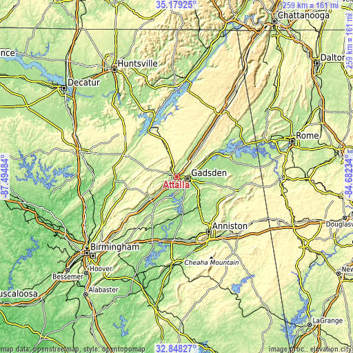
| Width | 8.1 km = 5 mi | 16.2 km = 10.1 mi | 259.2 km = 161.1 mi |
| Height | 8.1 km = 5 mi | 16.2 km = 10.1 mi | 259.2 km = 161.1 mi |
| ↑Max Latitude | 34.058175° | 34.094575° | 35.17925° |
| Latitude at center | 34.02176° | 34.02176° | 34.02176° |
| ↓Min Latitude | 33.985329° | 33.948883° | 32.84827° |
| ← Min Longitude | -86.132535° | -86.176481° | -87.49484° |
| Longitude center | -86.08859° | -86.08859° | -86.08859° |
| →Max Longitude | -86.044645° | -86.000699° | -84.68234° |
Nearby cities:
Cities around Attalla sort by population:
• Gadsden elevation 168 m
7.6 km,  96°
96°
• Boaz 328 m
21.1 km,  340°
340°
• Rainbow City 170 m
8.6 km,  149°
149°
• Southside 193 m
12.4 km, 150°
• Glencoe 165 m
16.1 km,  116°
116°
• Hokes Bluff 177 m
20.7 km, 97°
• Ashville 173 m
25.6 km,  216°
216°
• Whitesboro 326 m
15.9 km,  6°
6°
• Carlisle-Rockledge 331 m
10.8 km, 342°
• Sardis City 332 m
17.2 km,  349°
349°
• Ballplay 182 m
26.2 km,  80°
80°
• Steele 178 m
13.8 km,  228°
228°
Multilingual:
 En español:
Attalla elevación 165 m.
 En France:
Attalla élévation 165 m.


Sources and notes:
- [note 1] Map square and city borders are not equal. Map elevation data is calculated only from area inside that square.
- [src 1] Elevation data from geonames database provided with same terms of usage.
- [src 2] The elevation map of Attalla is generated using elevation data from NASA's 3 arcsec (90m) resolution SRTM data.
- [src 3] Base (background) map © OpenStreetMap contributors tiles are generated by Geofabrik and OpenTopoMap.
Copyright & License:
This Attalla Elevation Map is licensed under CC BY-SA. You may reuse any part from this page, if you give a proper credit by linking to this URL:
 More info on terms of use page.