Coalgate elevation
Coalgate (Oklahoma, Coal County), United States elevation is 193 meters and Coalgate elevation in feet is 633 ft above sea level [src 1]. Coalgate is a seat of a second-order administrative division (feature code) with elevation that is 86 meters (282 ft) smaller than average city elevation in United States.
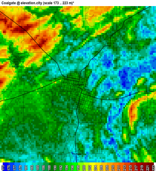
Below is the Elevation map of Coalgate, which displays elevation range with different colors. Scale of the first map is from 173 to 223 m (568 to 732 ft) with average elevation of 191.1 meters (=627 ft) [note 1]
These maps also provides idea of topography and contour of this city, they are displayed at different zoom levels. More info about maps, scale and edge coordinates you can find below images.
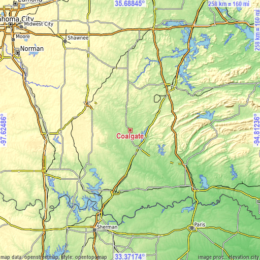
| \ | Map #1 | Topo.Map |
| Scale [m] | 173..223 m | × |
| Scale [ft] | 568..732 ft | × |
| Average | 191.1 m = 627 ft | × |
| Width | 8.05 km = 5 mi | 257.6 km = 160.1 mi |
| Height | 8.05 km = 5 mi | 257.6 km = 160.1 mi |
| ↑Max Latitude | 34.574342° | 35.68845° |
| Latitude at center | 34.53815° | 34.53815° |
| ↓Min Latitude | 34.501942° | 33.37174° |
| ← Min Longitude | -96.262555° | -97.62486° |
| Longitude center | -96.21861° | -96.21861° |
| →Max Longitude | -96.174665° | -94.81236° |
Nearby cities:
Cities around Coalgate sort by population:
• McAlester elevation 225 m
60.1 km,  43°
43°
• Ada 314 m
49.6 km,  302°
302°
• Durant 199 m
62.1 km,  193°
193°
• Holdenville 267 m
62.5 km,  344°
344°
• Sulphur 307 m
68.8 km,  267°
267°
• Tishomingo 207 m
53.9 km,  231°
231°
• Atoka 178 m
18.8 km,  153°
153°
• Antlers 161 m
64.6 km,  121°
121°
• Krebs 206 m
63.2 km,  46°
46°
• Konawa 299 m
67.7 km,  313°
313°
• Byng 299 m
54.4 km, 311°
• Caddo 228 m
45.9 km, 185°
Multilingual:
 En español:
Coalgate elevación 193 m.
 En France:
Coalgate élévation 193 m.
 Auf Deutsch:
Coalgate höhe über dem Meeresspiegel ist 193 m.

Sources and notes:
- [note 1] Map square and city borders are not equal. Map elevation data is calculated only from area inside that square.
- [src 1] Elevation data from geonames database provided with same terms of usage.
- [src 2] The elevation map of Coalgate is generated using elevation data from NASA's 3 arcsec (90m) resolution SRTM data.
- [src 3] Base (background) map © OpenStreetMap contributors tiles are generated by Geofabrik and OpenTopoMap.
Copyright & License:
This Coalgate Elevation Map is licensed under CC BY-SA. You may reuse any part from this page, if you give a proper credit by linking to this URL:
 More info on terms of use page.