Stuarts Draft elevation
Stuarts Draft (Virginia, Augusta County), United States elevation is 433 meters and Stuarts Draft elevation in feet is 1421 ft above sea level [src 1]. Stuarts Draft is a populated place (feature code) with elevation that is 154 meters (505 ft) bigger than average city elevation in United States.
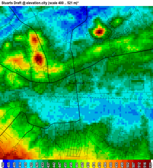
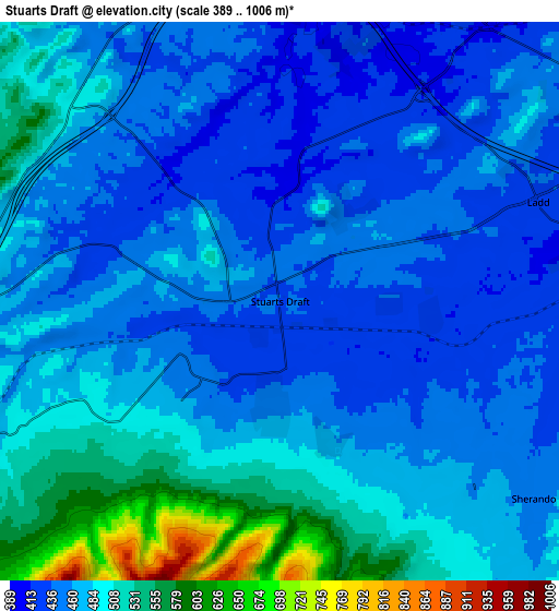
Below is the Elevation map of Stuarts Draft, which displays elevation range with different colors. Scale of the first map is from 400 to 521 m (1312 to 1709 ft) with average elevation of 439.1 meters (=1441 ft) [note 1]
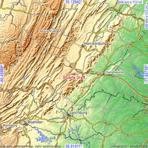
These maps also provides idea of topography and contour of this city, they are displayed at different zoom levels. More info about maps, scale and edge coordinates you can find below images.
| \ | Map #1 | Map #2 | Topo.Map |
| Scale [m] | 400..521 m | 389..1006 m | × |
| Scale [ft] | 1312..1709 ft | 1276..3301 ft | × |
| Average | 439.1 m = 1441 ft | 475.5 m = 1560 ft | × |
| Width | 7.7 km = 4.8 mi | 15.4 km = 9.6 mi | 246.3 km = 153 mi |
| Height | 7.7 km = 4.8 mi | 15.4 km = 9.6 mi | 246.3 km = 153 mi |
| ↑Max Latitude | 38.064747° | 38.099338° | 39.12942° |
| Latitude at center | 38.03014° | 38.03014° | 38.03014° |
| ↓Min Latitude | 37.995517° | 37.960877° | 36.91411° |
| ← Min Longitude | -79.077585° | -79.121531° | -80.43989° |
| Longitude center | -79.03364° | -79.03364° | -79.03364° |
| →Max Longitude | -78.989695° | -78.945749° | -77.62739° |
Nearby cities:
Cities around Stuarts Draft sort by population:
• Staunton elevation 434 m
13.8 km,  345°
345°
• Waynesboro 393 m
13.3 km,  71°
71°
• Fishersville 404 m
9.5 km,  36°
36°
• Crozet 217 m
29.5 km,  81°
81°
• Verona 390 m
19.2 km,  6°
6°
• Grottoes 339 m
32 km,  34°
34°
• Weyers Cave 355 m
30.6 km,  20°
20°
• Crimora 380 m
21.1 km,  49°
49°
• Lyndhurst 425 m
7.8 km,  90°
90°
• Dooms 384 m
17.7 km,  60°
60°
• Jolivue 491 m
9.5 km,  338°
338°
• Nellysford 208 m
21 km,  137°
137°
Multilingual:
 En español:
Stuarts Draft elevación 433 m.
 En France:
Stuarts Draft élévation 433 m.
 Auf Deutsch:
Stuarts Draft höhe über dem Meeresspiegel ist 433 m.

Sources and notes:
- [note 1] Map square and city borders are not equal. Map elevation data is calculated only from area inside that square.
- [src 1] Elevation data from geonames database provided with same terms of usage.
- [src 2] The elevation map of Stuarts Draft is generated using elevation data from NASA's 3 arcsec (90m) resolution SRTM data.
- [src 3] Base (background) map © OpenStreetMap contributors tiles are generated by Geofabrik and OpenTopoMap.
Copyright & License:
This Stuarts Draft Elevation Map is licensed under CC BY-SA. You may reuse any part from this page, if you give a proper credit by linking to this URL:
 More info on terms of use page.