South Riding elevation
South Riding (Virginia, Loudoun County), United States elevation is 101 meters and South Riding elevation in feet is 331 ft above sea level [src 1]. South Riding is a populated place (feature code) with elevation that is 178 meters (584 ft) smaller than average city elevation in United States.
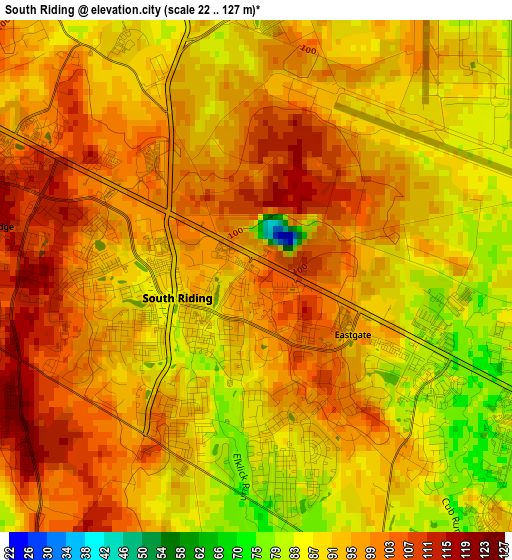
Below is the Elevation map of South Riding, which displays elevation range with different colors. Scale of the first map is from 22 to 127 m (72 to 417 ft) with average elevation of 93.9 meters (=308 ft) [note 1]
These maps also provides idea of topography and contour of this city, they are displayed at different zoom levels. More info about maps, scale and edge coordinates you can find below images.
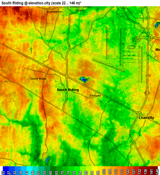
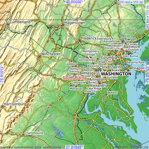
| \ | Map #1 | Map #2 | Topo.Map |
| Scale [m] | 22..127 m | 22..146 m | × |
| Scale [ft] | 72..417 ft | 72..479 ft | × |
| Average | 93.9 m = 308 ft | 93.3 m = 306 ft | × |
| Width | 7.6 km = 4.7 mi | 15.21 km = 9.5 mi | 243.3 km = 151.2 mi |
| Height | 7.6 km = 4.7 mi | 15.21 km = 9.5 mi | 243.3 km = 151.2 mi |
| ↑Max Latitude | 38.955122° | 38.989287° | 40.00656° |
| Latitude at center | 38.92094° | 38.92094° | 38.92094° |
| ↓Min Latitude | 38.886742° | 38.852527° | 37.81845° |
| ← Min Longitude | -77.547825° | -77.591771° | -78.91013° |
| Longitude center | -77.50388° | -77.50388° | -77.50388° |
| →Max Longitude | -77.459935° | -77.415989° | -76.09763° |
Nearby cities:
Cities around South Riding sort by population:
• Centreville elevation 110 m
11.1 km,  144°
144°
• Ashburn 89 m
13.7 km,  5°
5°
• Oak Hill 106 m
8.9 km,  86°
86°
• Sterling 90 m
11.5 km,  34°
34°
• Herndon 111 m
11.5 km,  62°
62°
• Chantilly 100 m
7 km,  115°
115°
• Broadlands 111 m
10.9 km,  352°
352°
• Brambleton 111 m
7.4 km,  336°
336°
• Floris 110 m
8.1 km,  77°
77°
• Greenbriar 112 m
10.4 km, 120°
• Loudoun Valley Estates 88 m
6.7 km,  357°
357°
• Oak Grove 117 m
11.1 km,  50°
50°
Multilingual:
 En español:
South Riding elevación 101 m.
 En France:
South Riding élévation 101 m.
 Auf Deutsch:
South Riding höhe über dem Meeresspiegel ist 101 m.

Sources and notes:
- [note 1] Map square and city borders are not equal. Map elevation data is calculated only from area inside that square.
- [src 1] Elevation data from geonames database provided with same terms of usage.
- [src 2] The elevation map of South Riding is generated using elevation data from NASA's 3 arcsec (90m) resolution SRTM data.
- [src 3] Base (background) map © OpenStreetMap contributors tiles are generated by Geofabrik and OpenTopoMap.
Copyright & License:
This South Riding Elevation Map is licensed under CC BY-SA. You may reuse any part from this page, if you give a proper credit by linking to this URL:
 More info on terms of use page.