Colonial Heights elevation
Colonial Heights (Virginia, City of Colonial Heights), United States elevation is 19 meters and Colonial Heights elevation in feet is 62 ft above sea level [src 1]. Colonial Heights is a seat of a second-order administrative division (feature code) with elevation that is 260 meters (853 ft) smaller than average city elevation in United States.
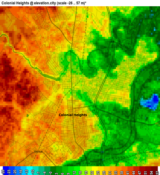
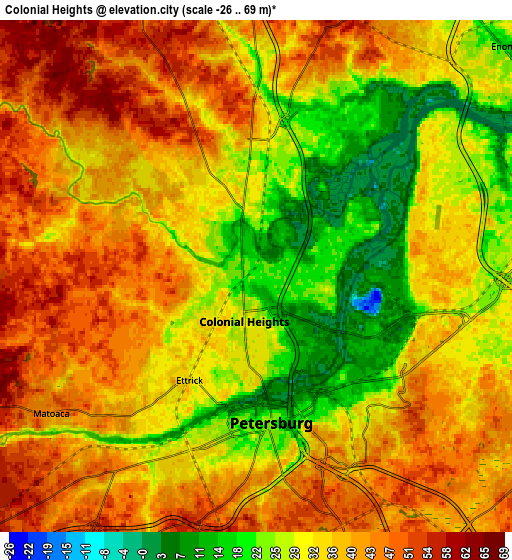
Below is the Elevation map of Colonial Heights, which displays elevation range with different colors. Scale of the first map is from -26 to 57 m (-85 to 187 ft) with average elevation of 22.6 meters (=74 ft) [note 1]
These maps also provides idea of topography and contour of this city, they are displayed at different zoom levels. More info about maps, scale and edge coordinates you can find below images.
| \ | Map #1 | Map #2 | Topo.Map |
| Scale [m] | -26..57 m | -26..69 m | × |
| Scale [ft] | -85..187 ft | -85..226 ft | × |
| Average | 22.6 m = 74 ft | 35.1 m = 115 ft | × |
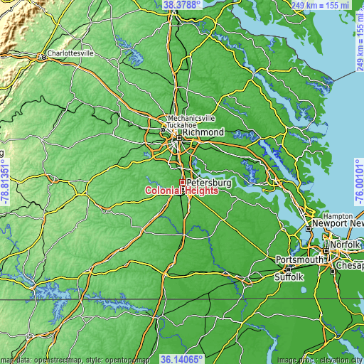
| Width | 7.78 km = 4.8 mi | 15.55 km = 9.7 mi | 248.9 km = 154.7 mi |
| Height | 7.78 km = 4.8 mi | 15.55 km = 9.7 mi | 248.9 km = 154.7 mi |
| ↑Max Latitude | 37.303004° | 37.337952° | 38.3788° |
| Latitude at center | 37.26804° | 37.26804° | 37.26804° |
| ↓Min Latitude | 37.23306° | 37.198063° | 36.14065° |
| ← Min Longitude | -77.451205° | -77.495151° | -78.81351° |
| Longitude center | -77.40726° | -77.40726° | -77.40726° |
| →Max Longitude | -77.363315° | -77.319369° | -76.00101° |
Nearby cities:
Cities around Colonial Heights sort by population:
• Petersburg elevation 22 m
4.5 km,  173°
173°
• Hopewell 16 m
11.4 km,  69°
69°
• Chester 55 m
10.3 km,  342°
342°
• Ettrick 33 m
3.7 km,  212°
212°
• Bellwood 32 m
17.3 km,  351°
351°
• Bensley 20 m
20.1 km, 350°
• Chesterfield Court House 62 m
14.9 km,  324°
324°
• Enon 12 m
10.2 km,  47°
47°
• Fort Lee 29 m
6.9 km,  109°
109°
• Matoaca 43 m
7.5 km,  236°
236°
• Prince George 41 m
11.8 km,  116°
116°
• Chesterfield 63 m
14.9 km, 324°
Multilingual:
 En español:
Colonial Heights elevación 19 m.
 En France:
Colonial Heights élévation 19 m.
 Auf Deutsch:
Colonial Heights höhe über dem Meeresspiegel ist 19 m.

Sources and notes:
- [note 1] Map square and city borders are not equal. Map elevation data is calculated only from area inside that square.
- [src 1] Elevation data from geonames database provided with same terms of usage.
- [src 2] The elevation map of Colonial Heights is generated using elevation data from NASA's 3 arcsec (90m) resolution SRTM data.
- [src 3] Base (background) map © OpenStreetMap contributors tiles are generated by Geofabrik and OpenTopoMap.
Copyright & License:
This Colonial Heights Elevation Map is licensed under CC BY-SA. You may reuse any part from this page, if you give a proper credit by linking to this URL:
 More info on terms of use page.