Brandermill elevation
Brandermill (Virginia, Chesterfield County), United States elevation is 74 meters and Brandermill elevation in feet is 243 ft above sea level [src 1]. Brandermill is a populated place (feature code) with elevation that is 205 meters (673 ft) smaller than average city elevation in United States.
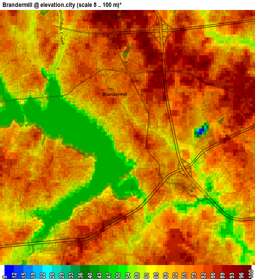
Below is the Elevation map of Brandermill, which displays elevation range with different colors. Scale of the first map is from 8 to 100 m (26 to 328 ft) with average elevation of 73.1 meters (=240 ft) [note 1]
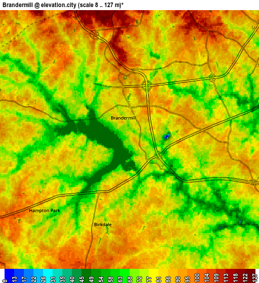
These maps also provides idea of topography and contour of this city, they are displayed at different zoom levels. More info about maps, scale and edge coordinates you can find below images.
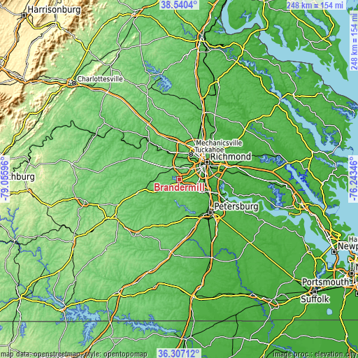
| \ | Map #1 | Map #2 | Topo.Map |
| Scale [m] | 8..100 m | 8..127 m | × |
| Scale [ft] | 26..328 ft | 26..417 ft | × |
| Average | 73.1 m = 240 ft | 80.4 m = 264 ft | × |
| Width | 7.76 km = 4.8 mi | 15.52 km = 9.6 mi | 248.3 km = 154.3 mi |
| Height | 7.76 km = 4.8 mi | 15.52 km = 9.6 mi | 248.3 km = 154.3 mi |
| ↑Max Latitude | 37.466978° | 37.501849° | 38.5404° |
| Latitude at center | 37.43209° | 37.43209° | 37.43209° |
| ↓Min Latitude | 37.397186° | 37.362266° | 36.30712° |
| ← Min Longitude | -77.693655° | -77.737601° | -79.05596° |
| Longitude center | -77.64971° | -77.64971° | -77.64971° |
| →Max Longitude | -77.605765° | -77.561819° | -76.24346° |
Nearby cities:
Cities around Brandermill sort by population:
• Richmond elevation 68 m
21.5 km,  51°
51°
• Tuckahoe 80 m
19.4 km,  25°
25°
• Short Pump 88 m
24.5 km,  7°
7°
• Chester 55 m
20.2 km,  114°
114°
• Meadowbrook 64 m
15.7 km,  83°
83°
• Bon Air 101 m
13.1 km,  38°
38°
• Dumbarton 66 m
23.7 km, 36°
• Woodlake 80 m
2.9 km,  244°
244°
• Bellwood 32 m
18.8 km,  93°
93°
• Bensley 20 m
18.3 km, 84°
• Chesterfield Court House 62 m
14.2 km,  115°
115°
• Chesterfield 63 m
14.1 km, 115°
Multilingual:
 En español:
Brandermill elevación 74 m.
 En France:
Brandermill élévation 74 m.
 Auf Deutsch:
Brandermill höhe über dem Meeresspiegel ist 74 m.

Sources and notes:
- [note 1] Map square and city borders are not equal. Map elevation data is calculated only from area inside that square.
- [src 1] Elevation data from geonames database provided with same terms of usage.
- [src 2] The elevation map of Brandermill is generated using elevation data from NASA's 3 arcsec (90m) resolution SRTM data.
- [src 3] Base (background) map © OpenStreetMap contributors tiles are generated by Geofabrik and OpenTopoMap.
Copyright & License:
This Brandermill Elevation Map is licensed under CC BY-SA. You may reuse any part from this page, if you give a proper credit by linking to this URL:
 More info on terms of use page.