Forney elevation
Forney (Texas, Kaufman County), United States elevation is 149 meters and Forney elevation in feet is 489 ft above sea level [src 1]. Forney is a populated place (feature code) with elevation that is 130 meters (427 ft) smaller than average city elevation in United States.
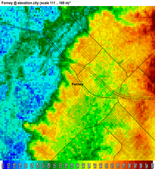
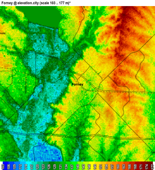
Below is the Elevation map of Forney, which displays elevation range with different colors. Scale of the first map is from 111 to 169 m (364 to 554 ft) with average elevation of 137.6 meters (=451 ft) [note 1]
These maps also provides idea of topography and contour of this city, they are displayed at different zoom levels. More info about maps, scale and edge coordinates you can find below images.
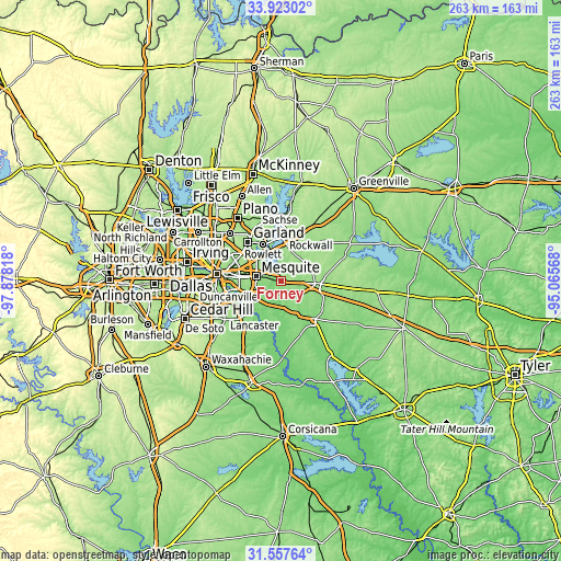
| \ | Map #1 | Map #2 | Topo.Map |
| Scale [m] | 111..169 m | 103..177 m | × |
| Scale [ft] | 364..554 ft | 338..581 ft | × |
| Average | 137.6 m = 451 ft | 139.3 m = 457 ft | × |
| Width | 8.22 km = 5.1 mi | 16.44 km = 10.2 mi | 263 km = 163.4 mi |
| Height | 8.22 km = 5.1 mi | 16.44 km = 10.2 mi | 263 km = 163.4 mi |
| ↑Max Latitude | 32.785133° | 32.82207° | 33.92302° |
| Latitude at center | 32.74818° | 32.74818° | 32.74818° |
| ↓Min Latitude | 32.711212° | 32.674228° | 31.55764° |
| ← Min Longitude | -96.515875° | -96.559821° | -97.87818° |
| Longitude center | -96.47193° | -96.47193° | -96.47193° |
| →Max Longitude | -96.427985° | -96.384039° | -95.06568° |
Nearby cities:
Cities around Forney sort by population:
• Mesquite elevation 155 m
12.1 km,  279°
279°
• Rowlett 155 m
19.2 km,  333°
333°
• Balch Springs 159 m
14.3 km,  261°
261°
• Terrell 158 m
18.4 km,  94°
94°
• Seagoville 139 m
13.6 km,  207°
207°
• Heath 157 m
9.8 km,  358°
358°
• Sunnyvale 152 m
9.9 km,  302°
302°
• Crandall 133 m
13.5 km,  173°
173°
• Travis Ranch 147 m
6.2 km, 358°
• McLendon-Chisholm 158 m
13.5 km,  39°
39°
• Combine 132 m
18.1 km,  190°
190°
• Talty 138 m
10.8 km,  131°
131°
Multilingual:
 En español:
Forney elevación 149 m.
 En France:
Forney élévation 149 m.


Sources and notes:
- [note 1] Map square and city borders are not equal. Map elevation data is calculated only from area inside that square.
- [src 1] Elevation data from geonames database provided with same terms of usage.
- [src 2] The elevation map of Forney is generated using elevation data from NASA's 3 arcsec (90m) resolution SRTM data.
- [src 3] Base (background) map © OpenStreetMap contributors tiles are generated by Geofabrik and OpenTopoMap.
Copyright & License:
This Forney Elevation Map is licensed under CC BY-SA. You may reuse any part from this page, if you give a proper credit by linking to this URL:
 More info on terms of use page.