Brownwood elevation
Brownwood (Texas, Brown County), United States elevation is 420 meters and Brownwood elevation in feet is 1378 ft above sea level [src 1]. Brownwood is a seat of a second-order administrative division (feature code) with elevation that is 141 meters (463 ft) bigger than average city elevation in United States.
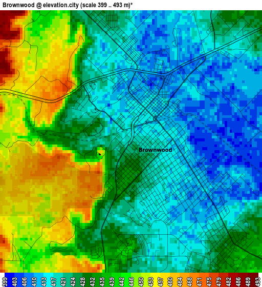
Below is the Elevation map of Brownwood, which displays elevation range with different colors. Scale of the first map is from 399 to 493 m (1309 to 1617 ft) with average elevation of 429.6 meters (=1409 ft) [note 1]
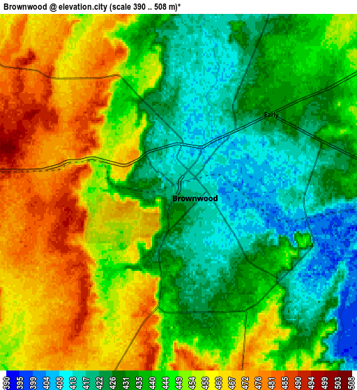
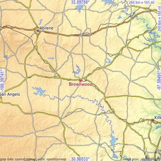
These maps also provides idea of topography and contour of this city, they are displayed at different zoom levels. More info about maps, scale and edge coordinates you can find below images.
| \ | Map #1 | Map #2 | Topo.Map |
| Scale [m] | 399..493 m | 390..508 m | × |
| Scale [ft] | 1309..1617 ft | 1280..1667 ft | × |
| Average | 429.6 m = 1409 ft | 444 m = 1457 ft | × |
| Width | 8.31 km = 5.2 mi | 16.63 km = 10.3 mi | 266 km = 165.3 mi |
| Height | 8.31 km = 5.2 mi | 16.63 km = 10.3 mi | 266 km = 165.3 mi |
| ↑Max Latitude | 31.746698° | 31.784061° | 32.89788° |
| Latitude at center | 31.70932° | 31.70932° | 31.70932° |
| ↓Min Latitude | 31.671927° | 31.634519° | 30.50533° |
| ← Min Longitude | -99.035105° | -99.079051° | -100.39741° |
| Longitude center | -98.99116° | -98.99116° | -98.99116° |
| →Max Longitude | -98.947215° | -98.903269° | -97.58491° |
Nearby cities:
Cities around Brownwood sort by population:
• Brady elevation 519 m
71.7 km,  207°
207°
• Coleman 521 m
43.2 km,  287°
287°
• Comanche 421 m
42.2 km,  60°
60°
• Dublin 453 m
74.2 km, 55°
• San Saba 373 m
62.7 km,  155°
155°
• Early 430 m
5.6 km,  49°
49°
• De Leon 396 m
62 km,  43°
43°
• Goldthwaite 484 m
49.2 km,  125°
125°
• Bangs 495 m
13.4 km,  273°
273°
• Lake Brownwood 446 m
14.1 km,  353°
353°
• Gorman 444 m
63.7 km,  28°
28°
• Santa Anna 540 m
31.5 km,  276°
276°
Multilingual:
 En español:
Brownwood elevación 420 m.
 En France:
Brownwood élévation 420 m.
 Auf Deutsch:
Brownwood höhe über dem Meeresspiegel ist 420 m.

Sources and notes:
- [note 1] Map square and city borders are not equal. Map elevation data is calculated only from area inside that square.
- [src 1] Elevation data from geonames database provided with same terms of usage.
- [src 2] The elevation map of Brownwood is generated using elevation data from NASA's 3 arcsec (90m) resolution SRTM data.
- [src 3] Base (background) map © OpenStreetMap contributors tiles are generated by Geofabrik and OpenTopoMap.
Copyright & License:
This Brownwood Elevation Map is licensed under CC BY-SA. You may reuse any part from this page, if you give a proper credit by linking to this URL:
 More info on terms of use page.