Bowie elevation
Bowie (Texas, Montague County), United States elevation is 350 meters and Bowie elevation in feet is 1148 ft above sea level [src 1]. Bowie is a populated place (feature code) with elevation that is 71 meters (233 ft) bigger than average city elevation in United States.
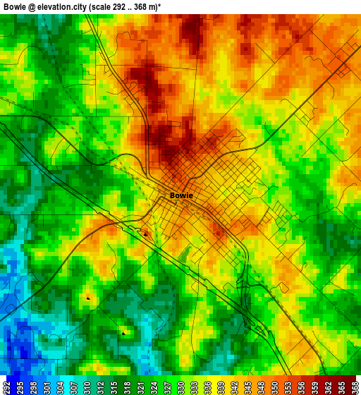
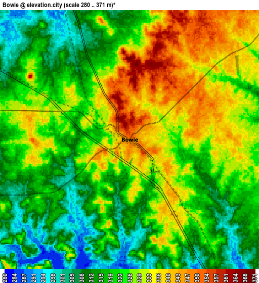
Below is the Elevation map of Bowie, which displays elevation range with different colors. Scale of the first map is from 292 to 368 m (958 to 1207 ft) with average elevation of 332 meters (=1089 ft) [note 1]
These maps also provides idea of topography and contour of this city, they are displayed at different zoom levels. More info about maps, scale and edge coordinates you can find below images.
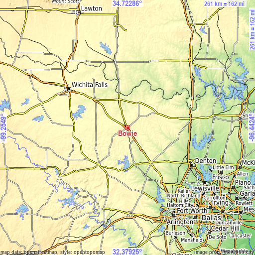
| \ | Map #1 | Map #2 | Topo.Map |
| Scale [m] | 292..368 m | 280..371 m | × |
| Scale [ft] | 958..1207 ft | 919..1217 ft | × |
| Average | 332 m = 1089 ft | 322.9 m = 1059 ft | × |
| Width | 8.14 km = 5.1 mi | 16.29 km = 10.1 mi | 260.6 km = 161.9 mi |
| Height | 8.14 km = 5.1 mi | 16.29 km = 10.1 mi | 260.6 km = 161.9 mi |
| ↑Max Latitude | 33.595613° | 33.63221° | 34.72286° |
| Latitude at center | 33.559° | 33.559° | 33.559° |
| ↓Min Latitude | 33.522372° | 33.485728° | 32.37925° |
| ← Min Longitude | -97.892595° | -97.936541° | -99.2549° |
| Longitude center | -97.84865° | -97.84865° | -97.84865° |
| →Max Longitude | -97.804705° | -97.760759° | -96.4424° |
Nearby cities:
Cities around Bowie sort by population:
• Decatur elevation 339 m
43.6 km,  145°
145°
• Bridgeport 247 m
39.8 km,  167°
167°
• Jacksboro 336 m
47.6 km,  217°
217°
• Henrietta 283 m
43.1 km,  311°
311°
• Nocona 303 m
27.8 km,  24°
24°
• Muenster 308 m
44.9 km,  76°
76°
• Runaway Bay 283 m
43.6 km,  183°
183°
• Alvord 272 m
26.5 km, 147°
• Lindsay 244 m
58.6 km, 81°
• Chico 289 m
29.6 km, 171°
• Saint Jo 353 m
33.8 km,  63°
63°
• Montague 331 m
16.7 km,  45°
45°
Multilingual:
 En español:
Bowie elevación 350 m.
 En France:
Bowie élévation 350 m.


Sources and notes:
- [note 1] Map square and city borders are not equal. Map elevation data is calculated only from area inside that square.
- [src 1] Elevation data from geonames database provided with same terms of usage.
- [src 2] The elevation map of Bowie is generated using elevation data from NASA's 3 arcsec (90m) resolution SRTM data.
- [src 3] Base (background) map © OpenStreetMap contributors tiles are generated by Geofabrik and OpenTopoMap.
Copyright & License:
This Bowie Elevation Map is licensed under CC BY-SA. You may reuse any part from this page, if you give a proper credit by linking to this URL:
 More info on terms of use page.