Bridgeport elevation
Bridgeport (Texas, Wise County), United States elevation is 247 meters and Bridgeport elevation in feet is 810 ft above sea level [src 1]. Bridgeport is a populated place (feature code) with elevation that is 32 meters (105 ft) smaller than average city elevation in United States.
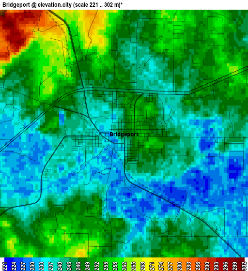
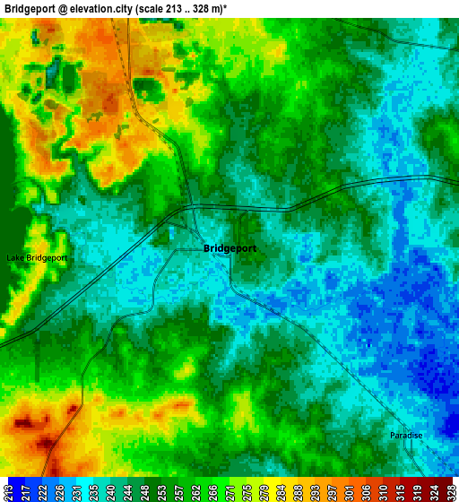
Below is the Elevation map of Bridgeport, which displays elevation range with different colors. Scale of the first map is from 221 to 302 m (725 to 991 ft) with average elevation of 245.3 meters (=805 ft) [note 1]
These maps also provides idea of topography and contour of this city, they are displayed at different zoom levels. More info about maps, scale and edge coordinates you can find below images.
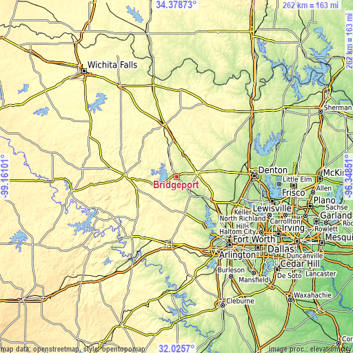
| \ | Map #1 | Map #2 | Topo.Map |
| Scale [m] | 221..302 m | 213..328 m | × |
| Scale [ft] | 725..991 ft | 699..1076 ft | × |
| Average | 245.3 m = 805 ft | 253.6 m = 832 ft | × |
| Width | 8.18 km = 5.1 mi | 16.35 km = 10.2 mi | 261.6 km = 162.6 mi |
| Height | 8.18 km = 5.1 mi | 16.35 km = 10.2 mi | 261.6 km = 162.6 mi |
| ↑Max Latitude | 33.24688° | 33.283624° | 34.37873° |
| Latitude at center | 33.21012° | 33.21012° | 33.21012° |
| ↓Min Latitude | 33.173345° | 33.136554° | 32.0257° |
| ← Min Longitude | -97.798705° | -97.842651° | -99.16101° |
| Longitude center | -97.75476° | -97.75476° | -97.75476° |
| →Max Longitude | -97.710815° | -97.666869° | -96.34851° |
Nearby cities:
Cities around Bridgeport sort by population:
• Decatur elevation 339 m
15.9 km,  80°
80°
• Briar 231 m
31 km,  140°
140°
• Springtown 265 m
27.9 km,  166°
166°
• Reno 227 m
33.9 km,  150°
150°
• Rhome 290 m
31.6 km,  123°
123°
• Runaway Bay 283 m
12.4 km,  247°
247°
• Alvord 272 m
17.4 km,  18°
18°
• Boyd 224 m
22.9 km,  129°
129°
• New Fairview 286 m
31.2 km,  113°
113°
• Aurora 254 m
28.7 km, 125°
• Fairview 229 m
28.8 km, 137°
• Chico 289 m
10.4 km,  336°
336°
Multilingual:
 En español:
Bridgeport elevación 247 m.
 En France:
Bridgeport élévation 247 m.
 Auf Deutsch:
Bridgeport höhe über dem Meeresspiegel ist 247 m.

Sources and notes:
- [note 1] Map square and city borders are not equal. Map elevation data is calculated only from area inside that square.
- [src 1] Elevation data from geonames database provided with same terms of usage.
- [src 2] The elevation map of Bridgeport is generated using elevation data from NASA's 3 arcsec (90m) resolution SRTM data.
- [src 3] Base (background) map © OpenStreetMap contributors tiles are generated by Geofabrik and OpenTopoMap.
Copyright & License:
This Bridgeport Elevation Map is licensed under CC BY-SA. You may reuse any part from this page, if you give a proper credit by linking to this URL:
 More info on terms of use page.