Ballinger elevation
Ballinger (Texas, Runnels County), United States elevation is 499 meters and Ballinger elevation in feet is 1637 ft above sea level [src 1]. Ballinger is a seat of a second-order administrative division (feature code) with elevation that is 220 meters (722 ft) bigger than average city elevation in United States.
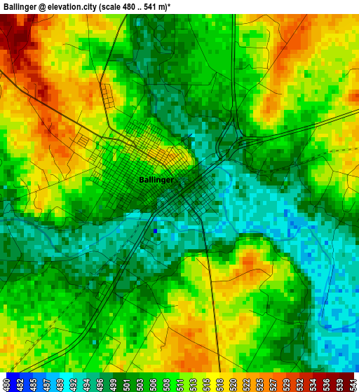
Below is the Elevation map of Ballinger, which displays elevation range with different colors. Scale of the first map is from 480 to 541 m (1575 to 1775 ft) with average elevation of 507.5 meters (=1665 ft) [note 1]
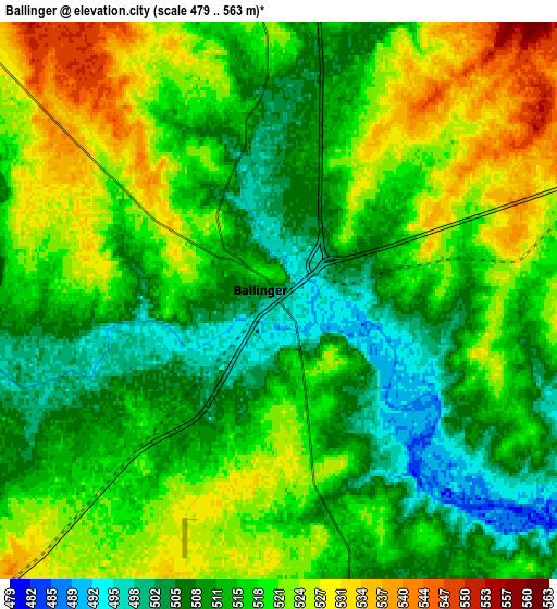
These maps also provides idea of topography and contour of this city, they are displayed at different zoom levels. More info about maps, scale and edge coordinates you can find below images.
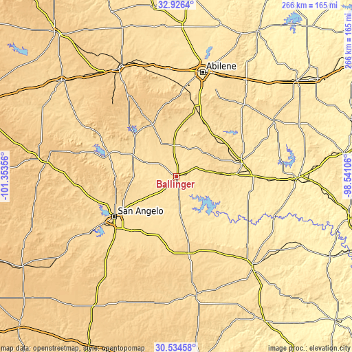
| \ | Map #1 | Map #2 | Topo.Map |
| Scale [m] | 480..541 m | 479..563 m | × |
| Scale [ft] | 1575..1775 ft | 1572..1847 ft | × |
| Average | 507.5 m = 1665 ft | 516.1 m = 1693 ft | × |
| Width | 8.31 km = 5.2 mi | 16.62 km = 10.3 mi | 265.9 km = 165.2 mi |
| Height | 8.31 km = 5.2 mi | 16.62 km = 10.3 mi | 265.9 km = 165.2 mi |
| ↑Max Latitude | 31.775576° | 31.812927° | 32.9264° |
| Latitude at center | 31.73821° | 31.73821° | 31.73821° |
| ↓Min Latitude | 31.700829° | 31.663432° | 30.53458° |
| ← Min Longitude | -99.991255° | -100.035201° | -101.35356° |
| Longitude center | -99.94731° | -99.94731° | -99.94731° |
| →Max Longitude | -99.903365° | -99.859419° | -98.54106° |
Nearby cities:
Cities around Ballinger sort by population:
• Abilene elevation 525 m
81.5 km,  14°
14°
• San Angelo 564 m
55.5 km,  236°
236°
• Coleman 521 m
50.2 km,  78°
78°
• Grape Creek 607 m
59.5 km,  252°
252°
• Potosi 557 m
71.2 km,  22°
22°
• Eden 626 m
58.8 km,  170°
170°
• Winters 564 m
24.3 km,  356°
356°
• Bangs 495 m
77.1 km,  91°
91°
• Tye 549 m
80.3 km, 5°
• Santa Anna 540 m
59.2 km, 89°
• Robert Lee 557 m
53.6 km,  288°
288°
• Paint Rock 499 m
25.7 km, 174°
Multilingual:
 En español:
Ballinger elevación 499 m.
 En France:
Ballinger élévation 499 m.
 Auf Deutsch:
Ballinger höhe über dem Meeresspiegel ist 499 m.

Sources and notes:
- [note 1] Map square and city borders are not equal. Map elevation data is calculated only from area inside that square.
- [src 1] Elevation data from geonames database provided with same terms of usage.
- [src 2] The elevation map of Ballinger is generated using elevation data from NASA's 3 arcsec (90m) resolution SRTM data.
- [src 3] Base (background) map © OpenStreetMap contributors tiles are generated by Geofabrik and OpenTopoMap.
Copyright & License:
This Ballinger Elevation Map is licensed under CC BY-SA. You may reuse any part from this page, if you give a proper credit by linking to this URL:
 More info on terms of use page.