Munford elevation
Munford (Tennessee, Tipton County), United States elevation is 135 meters and Munford elevation in feet is 443 ft above sea level [src 1]. Munford is a populated place (feature code) with elevation that is 144 meters (472 ft) smaller than average city elevation in United States.
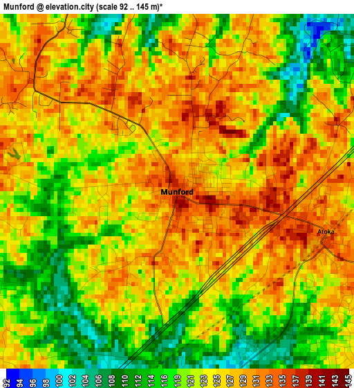
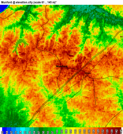
Below is the Elevation map of Munford, which displays elevation range with different colors. Scale of the first map is from 92 to 145 m (302 to 476 ft) with average elevation of 123.1 meters (=404 ft) [note 1]
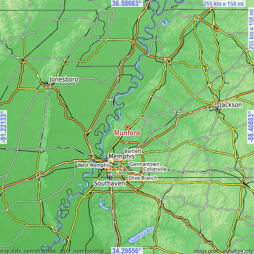
These maps also provides idea of topography and contour of this city, they are displayed at different zoom levels. More info about maps, scale and edge coordinates you can find below images.
| \ | Map #1 | Map #2 | Topo.Map |
| Scale [m] | 92..145 m | 61..145 m | × |
| Scale [ft] | 302..476 ft | 200..476 ft | × |
| Average | 123.1 m = 404 ft | 113.9 m = 374 ft | × |
| Width | 7.96 km = 4.9 mi | 15.92 km = 9.9 mi | 254.7 km = 158.3 mi |
| Height | 7.96 km = 4.9 mi | 15.92 km = 9.9 mi | 254.7 km = 158.3 mi |
| ↑Max Latitude | 35.485041° | 35.520816° | 36.58663° |
| Latitude at center | 35.44925° | 35.44925° | 35.44925° |
| ↓Min Latitude | 35.413443° | 35.37762° | 34.29556° |
| ← Min Longitude | -89.859025° | -89.902971° | -91.22133° |
| Longitude center | -89.81508° | -89.81508° | -89.81508° |
| →Max Longitude | -89.771135° | -89.727189° | -88.40883° |
Nearby cities:
Cities around Munford sort by population:
• Bartlett elevation 87 m
27.7 km,  191°
191°
• Lakeland 129 m
25.2 km,  164°
164°
• Arlington 87 m
22 km,  140°
140°
• Millington 81 m
14.1 km,  211°
211°
• Atoka 131 m
3.5 km,  104°
104°
• Covington 105 m
19.9 km,  50°
50°
• Oakland 113 m
36.6 km,  131°
131°
• Osceola 75 m
31.7 km,  333°
333°
• Brighton 103 m
9 km,  64°
64°
• Hickory Withe 126 m
30.7 km, 138°
• Mason 95 m
25.9 km, 99°
• Luxora 74 m
35.6 km,  343°
343°
Multilingual:
 En español:
Munford elevación 135 m.
 En France:
Munford élévation 135 m.


Sources and notes:
- [note 1] Map square and city borders are not equal. Map elevation data is calculated only from area inside that square.
- [src 1] Elevation data from geonames database provided with same terms of usage.
- [src 2] The elevation map of Munford is generated using elevation data from NASA's 3 arcsec (90m) resolution SRTM data.
- [src 3] Base (background) map © OpenStreetMap contributors tiles are generated by Geofabrik and OpenTopoMap.
Copyright & License:
This Munford Elevation Map is licensed under CC BY-SA. You may reuse any part from this page, if you give a proper credit by linking to this URL:
 More info on terms of use page.