Manchester elevation
Manchester (Tennessee, Coffee County), United States elevation is 325 meters and Manchester elevation in feet is 1066 ft above sea level [src 1]. Manchester is a seat of a second-order administrative division (feature code) with elevation that is 46 meters (151 ft) bigger than average city elevation in United States.
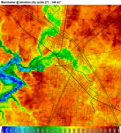
Below is the Elevation map of Manchester, which displays elevation range with different colors. Scale of the first map is from 271 to 346 m (889 to 1135 ft) with average elevation of 323.6 meters (=1062 ft) [note 1]
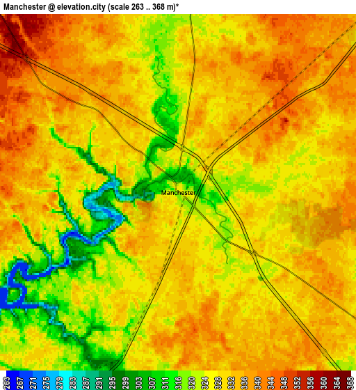
These maps also provides idea of topography and contour of this city, they are displayed at different zoom levels. More info about maps, scale and edge coordinates you can find below images.
| \ | Map #1 | Map #2 | Topo.Map |
| Scale [m] | 271..346 m | 263..368 m | × |
| Scale [ft] | 889..1135 ft | 863..1207 ft | × |
| Average | 323.6 m = 1062 ft | 328.6 m = 1078 ft | × |
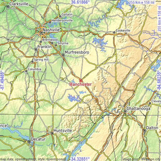
| Width | 7.96 km = 4.9 mi | 15.92 km = 9.9 mi | 254.6 km = 158.2 mi |
| Height | 7.96 km = 4.9 mi | 15.92 km = 9.9 mi | 254.6 km = 158.2 mi |
| ↑Max Latitude | 35.517517° | 35.553278° | 36.61866° |
| Latitude at center | 35.48174° | 35.48174° | 35.48174° |
| ↓Min Latitude | 35.445947° | 35.410139° | 34.32851° |
| ← Min Longitude | -86.132545° | -86.176491° | -87.49485° |
| Longitude center | -86.0886° | -86.0886° | -86.0886° |
| →Max Longitude | -86.044655° | -86.000709° | -84.68235° |
Nearby cities:
Cities around Manchester sort by population:
• Shelbyville elevation 237 m
33.7 km,  270°
270°
• Tullahoma 326 m
17.2 km,  219°
219°
• McMinnville 294 m
36.5 km,  52°
52°
• Winchester 298 m
33 km,  183°
183°
• Lynchburg 245 m
34 km,  229°
229°
• Decherd 291 m
30.2 km, 178°
• Sewanee 591 m
34.5 km,  153°
153°
• Estill Springs 288 m
23.7 km,  188°
188°
• Cowan 295 m
36 km,  168°
168°
• New Union 331 m
5.7 km,  7°
7°
• Monteagle 587 m
35.1 km,  139°
139°
• Altamont 564 m
33.6 km,  99°
99°
Multilingual:
 En español:
Manchester elevación 325 m.
 En France:
Manchester élévation 325 m.
 Auf Deutsch:
Manchester höhe über dem Meeresspiegel ist 325 m.

Sources and notes:
- [note 1] Map square and city borders are not equal. Map elevation data is calculated only from area inside that square.
- [src 1] Elevation data from geonames database provided with same terms of usage.
- [src 2] The elevation map of Manchester is generated using elevation data from NASA's 3 arcsec (90m) resolution SRTM data.
- [src 3] Base (background) map © OpenStreetMap contributors tiles are generated by Geofabrik and OpenTopoMap.
Copyright & License:
This Manchester Elevation Map is licensed under CC BY-SA. You may reuse any part from this page, if you give a proper credit by linking to this URL:
 More info on terms of use page.