Williamston elevation
Williamston (South Carolina, Anderson County), United States elevation is 249 meters and Williamston elevation in feet is 817 ft above sea level [src 1]. Williamston is a populated place (feature code) with elevation that is 30 meters (98 ft) smaller than average city elevation in United States.
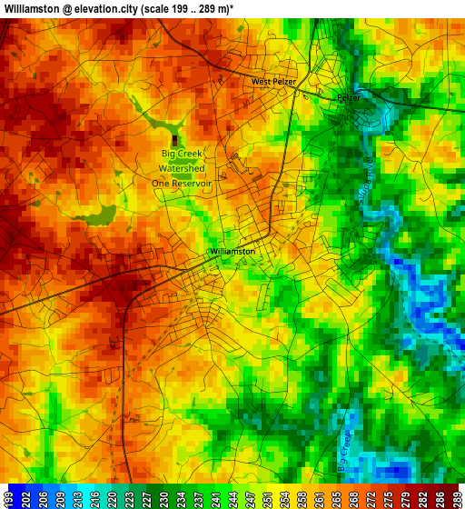
Below is the Elevation map of Williamston, which displays elevation range with different colors. Scale of the first map is from 199 to 289 m (653 to 948 ft) with average elevation of 253.1 meters (=830 ft) [note 1]
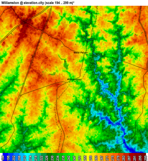
These maps also provides idea of topography and contour of this city, they are displayed at different zoom levels. More info about maps, scale and edge coordinates you can find below images.
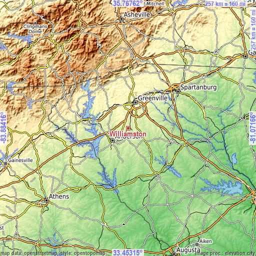
| \ | Map #1 | Map #2 | Topo.Map |
| Scale [m] | 199..289 m | 194..299 m | × |
| Scale [ft] | 653..948 ft | 636..981 ft | × |
| Average | 253.1 m = 830 ft | 253 m = 830 ft | × |
| Width | 8.04 km = 5 mi | 16.08 km = 10 mi | 257.3 km = 159.9 mi |
| Height | 8.04 km = 5 mi | 16.08 km = 10 mi | 257.3 km = 159.9 mi |
| ↑Max Latitude | 34.654607° | 34.690748° | 35.76762° |
| Latitude at center | 34.61845° | 34.61845° | 34.61845° |
| ↓Min Latitude | 34.582277° | 34.546089° | 33.45315° |
| ← Min Longitude | -82.521855° | -82.565801° | -83.88416° |
| Longitude center | -82.47791° | -82.47791° | -82.47791° |
| →Max Longitude | -82.433965° | -82.390019° | -81.07166° |
Nearby cities:
Cities around Williamston sort by population:
• Anderson elevation 245 m
20.3 km,  230°
230°
• Mauldin 289 m
23.5 km,  40°
40°
• Gantt 302 m
20.8 km,  13°
13°
• Powdersville 296 m
19.3 km,  355°
355°
• Welcome 301 m
23.4 km, 8°
• Centerville 255 m
22.8 km,  245°
245°
• Piedmont 240 m
9.4 km, 7°
• Belton 269 m
10.7 km,  188°
188°
• Northlake 204 m
19.7 km, 252°
• Honea Path 242 m
20.7 km,  157°
157°
• Dunean 299 m
23.6 km, 13°
• Golden Grove 269 m
13.2 km, 13°
Multilingual:
 En español:
Williamston elevación 249 m.
 En France:
Williamston élévation 249 m.
 Auf Deutsch:
Williamston höhe über dem Meeresspiegel ist 249 m.

Sources and notes:
- [note 1] Map square and city borders are not equal. Map elevation data is calculated only from area inside that square.
- [src 1] Elevation data from geonames database provided with same terms of usage.
- [src 2] The elevation map of Williamston is generated using elevation data from NASA's 3 arcsec (90m) resolution SRTM data.
- [src 3] Base (background) map © OpenStreetMap contributors tiles are generated by Geofabrik and OpenTopoMap.
Copyright & License:
This Williamston Elevation Map is licensed under CC BY-SA. You may reuse any part from this page, if you give a proper credit by linking to this URL:
 More info on terms of use page.