Centerville elevation
Centerville (South Carolina, Anderson County), United States elevation is 255 meters and Centerville elevation in feet is 837 ft above sea level [src 1]. Centerville is a populated place (feature code) with elevation that is 24 meters (79 ft) smaller than average city elevation in United States.
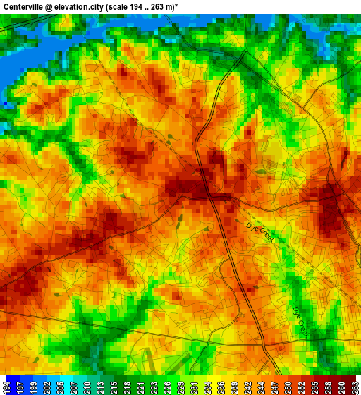
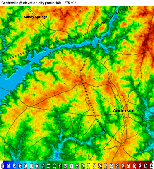
Below is the Elevation map of Centerville, which displays elevation range with different colors. Scale of the first map is from 194 to 263 m (636 to 863 ft) with average elevation of 236.6 meters (=776 ft) [note 1]
These maps also provides idea of topography and contour of this city, they are displayed at different zoom levels. More info about maps, scale and edge coordinates you can find below images.
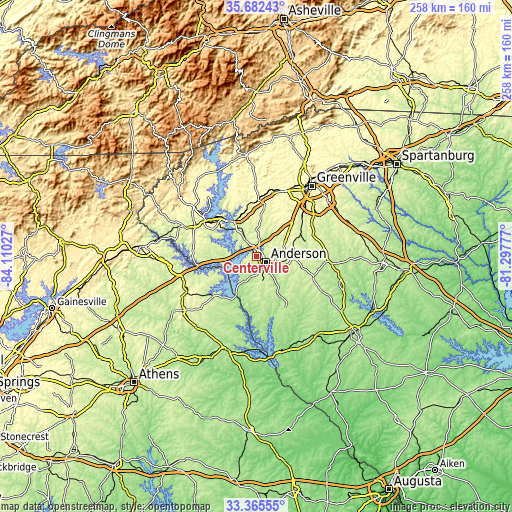
| \ | Map #1 | Map #2 | Topo.Map |
| Scale [m] | 194..263 m | 189..275 m | × |
| Scale [ft] | 636..863 ft | 620..902 ft | × |
| Average | 236.6 m = 776 ft | 233.5 m = 766 ft | × |
| Width | 8.05 km = 5 mi | 16.1 km = 10 mi | 257.6 km = 160.1 mi |
| Height | 8.05 km = 5 mi | 16.1 km = 10 mi | 257.6 km = 160.1 mi |
| ↑Max Latitude | 34.568245° | 34.604424° | 35.68243° |
| Latitude at center | 34.53205° | 34.53205° | 34.53205° |
| ↓Min Latitude | 34.49584° | 34.459613° | 33.36555° |
| ← Min Longitude | -82.747965° | -82.791911° | -84.11027° |
| Longitude center | -82.70402° | -82.70402° | -82.70402° |
| →Max Longitude | -82.660075° | -82.616129° | -81.29777° |
Nearby cities:
Cities around Centerville sort by population:
• Anderson elevation 245 m
5.9 km,  122°
122°
• Clemson 222 m
20.8 km,  324°
324°
• Homeland Park 241 m
7.5 km,  155°
155°
• Central 278 m
22.5 km,  341°
341°
• Belton 269 m
19.2 km,  93°
93°
• Williamston 249 m
22.8 km,  65°
65°
• Northlake 204 m
4.2 km,  25°
25°
• Liberty 301 m
28.5 km,  2°
2°
• Pendleton 261 m
15.2 km,  331°
331°
• Reed Creek 252 m
22.4 km,  244°
244°
• Utica 271 m
26.4 km,  307°
307°
• Iva 221 m
25.3 km,  171°
171°
Multilingual:
 En español:
Centerville elevación 255 m.
 En France:
Centerville élévation 255 m.
 Auf Deutsch:
Centerville höhe über dem Meeresspiegel ist 255 m.

Sources and notes:
- [note 1] Map square and city borders are not equal. Map elevation data is calculated only from area inside that square.
- [src 1] Elevation data from geonames database provided with same terms of usage.
- [src 2] The elevation map of Centerville is generated using elevation data from NASA's 3 arcsec (90m) resolution SRTM data.
- [src 3] Base (background) map © OpenStreetMap contributors tiles are generated by Geofabrik and OpenTopoMap.
Copyright & License:
This Centerville Elevation Map is licensed under CC BY-SA. You may reuse any part from this page, if you give a proper credit by linking to this URL:
 More info on terms of use page.