Boiling Springs elevation
Boiling Springs (South Carolina, Barnwell County), United States elevation is 69 meters and Boiling Springs elevation in feet is 226 ft above sea level [src 1]. Boiling Springs is a populated place (feature code) with elevation that is 210 meters (689 ft) smaller than average city elevation in United States.
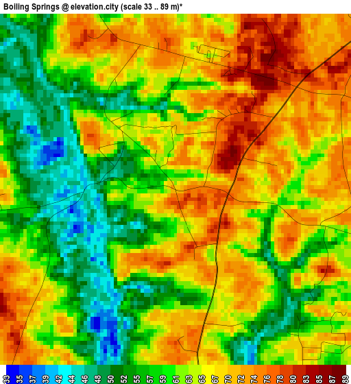
Below is the Elevation map of Boiling Springs, which displays elevation range with different colors. Scale of the first map is from 33 to 89 m (108 to 292 ft) with average elevation of 63.6 meters (=209 ft) [note 1]
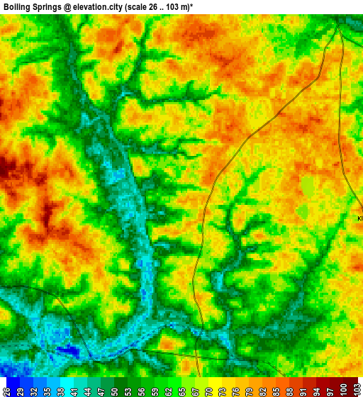
These maps also provides idea of topography and contour of this city, they are displayed at different zoom levels. More info about maps, scale and edge coordinates you can find below images.
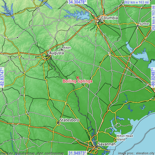
| \ | Map #1 | Map #2 | Topo.Map |
| Scale [m] | 33..89 m | 26..103 m | × |
| Scale [ft] | 108..292 ft | 85..338 ft | × |
| Average | 63.6 m = 209 ft | 65.6 m = 215 ft | × |
| Width | 8.18 km = 5.1 mi | 16.37 km = 10.2 mi | 261.9 km = 162.7 mi |
| Height | 8.18 km = 5.1 mi | 16.37 km = 10.2 mi | 261.9 km = 162.7 mi |
| ↑Max Latitude | 33.171941° | 33.208717° | 34.30478° |
| Latitude at center | 33.13515° | 33.13515° | 33.13515° |
| ↓Min Latitude | 33.098343° | 33.061521° | 31.94973° |
| ← Min Longitude | -81.475165° | -81.519111° | -82.83747° |
| Longitude center | -81.43122° | -81.43122° | -81.43122° |
| →Max Longitude | -81.387275° | -81.343329° | -80.02497° |
Nearby cities:
Cities around Boiling Springs sort by population:
• Barnwell elevation 69 m
13.9 km,  28°
28°
• Bamberg 52 m
41 km,  63°
63°
• Denmark 76 m
34 km,  52°
52°
• Allendale 60 m
18.2 km,  141°
141°
• Williston 109 m
29.8 km,  1°
1°
• Hampton 41 m
40.2 km, 135°
• Blackville 93 m
28.9 km, 31°
• New Ellenton 127 m
39.7 km,  323°
323°
• Varnville 37 m
45.6 km,  133°
133°
• Estill 37 m
45.8 km,  157°
157°
• Fairfax 45 m
26.7 km, 137°
• Jackson 65 m
39.3 km,  302°
302°
Multilingual:
 En español:
Boiling Springs elevación 69 m.
 En France:
Boiling Springs élévation 69 m.
 Auf Deutsch:
Boiling Springs höhe über dem Meeresspiegel ist 69 m.

Sources and notes:
- [note 1] Map square and city borders are not equal. Map elevation data is calculated only from area inside that square.
- [src 1] Elevation data from geonames database provided with same terms of usage.
- [src 2] The elevation map of Boiling Springs is generated using elevation data from NASA's 3 arcsec (90m) resolution SRTM data.
- [src 3] Base (background) map © OpenStreetMap contributors tiles are generated by Geofabrik and OpenTopoMap.
Copyright & License:
This Boiling Springs Elevation Map is licensed under CC BY-SA. You may reuse any part from this page, if you give a proper credit by linking to this URL:
 More info on terms of use page.