Morrisville elevation
Morrisville (Pennsylvania, Greene County), United States elevation is 297 meters and Morrisville elevation in feet is 974 ft above sea level [src 1]. Morrisville is a populated place (feature code) with elevation that is 18 meters (59 ft) bigger than average city elevation in United States.
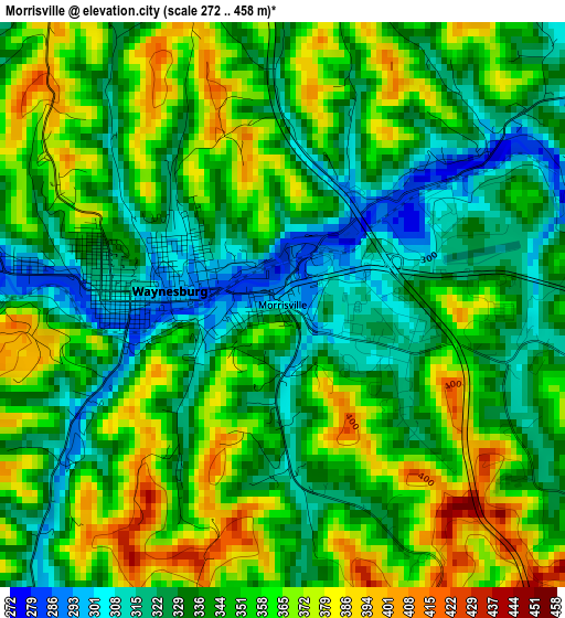
Below is the Elevation map of Morrisville, which displays elevation range with different colors. Scale of the first map is from 272 to 458 m (892 to 1503 ft) with average elevation of 346.2 meters (=1136 ft) [note 1]
These maps also provides idea of topography and contour of this city, they are displayed at different zoom levels. More info about maps, scale and edge coordinates you can find below images.
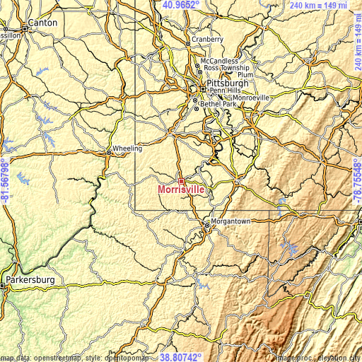
| \ | Map #1 | Topo.Map |
| Scale [m] | 272..458 m | × |
| Scale [ft] | 892..1503 ft | × |
| Average | 346.2 m = 1136 ft | × |
| Width | 7.5 km = 4.7 mi | 239.9 km = 149.1 mi |
| Height | 7.5 km = 4.7 mi | 239.9 km = 149.1 mi |
| ↑Max Latitude | 39.928508° | 40.9652° |
| Latitude at center | 39.8948° | 39.8948° |
| ↓Min Latitude | 39.861076° | 38.80742° |
| ← Min Longitude | -80.205675° | -81.56798° |
| Longitude center | -80.16173° | -80.16173° |
| →Max Longitude | -80.117785° | -78.75548° |
Nearby cities:
Cities around Morrisville sort by population:
• Maple Glen elevation 247 m
20.7 km,  49°
49°
• California 241 m
29.8 km, 50°
• Waynesburg 296 m
1.5 km,  277°
277°
• Masontown 315 m
23 km,  103°
103°
• Centerville 354 m
23.1 km,  43°
43°
• Luzerne 237 m
20.6 km,  55°
55°
• Bentleyville 289 m
27.9 km,  27°
27°
• Brownsville 247 m
27.7 km, 58°
• Fairdale 304 m
16.5 km,  92°
92°
• Hiller 311 m
25.7 km, 59°
• Point Marion 253 m
28.4 km,  127°
127°
• Republic 297 m
25.4 km,  72°
72°
Multilingual:
 En español:
Morrisville elevación 297 m.
 En France:
Morrisville élévation 297 m.
 Auf Deutsch:
Morrisville höhe über dem Meeresspiegel ist 297 m.

Sources and notes:
- [note 1] Map square and city borders are not equal. Map elevation data is calculated only from area inside that square.
- [src 1] Elevation data from geonames database provided with same terms of usage.
- [src 2] The elevation map of Morrisville is generated using elevation data from NASA's 3 arcsec (90m) resolution SRTM data.
- [src 3] Base (background) map © OpenStreetMap contributors tiles are generated by Geofabrik and OpenTopoMap.
Copyright & License:
This Morrisville Elevation Map is licensed under CC BY-SA. You may reuse any part from this page, if you give a proper credit by linking to this URL:
 More info on terms of use page.