Bartlesville elevation
Bartlesville (Oklahoma, Washington County), United States elevation is 217 meters and Bartlesville elevation in feet is 712 ft above sea level [src 1]. Bartlesville is a seat of a second-order administrative division (feature code) with elevation that is 62 meters (203 ft) smaller than average city elevation in United States.
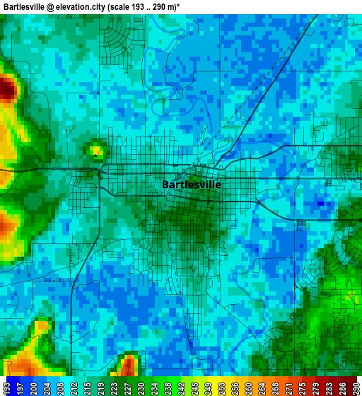
Below is the Elevation map of Bartlesville, which displays elevation range with different colors. Scale of the first map is from 193 to 290 m (633 to 951 ft) with average elevation of 214.1 meters (=702 ft) [note 1]
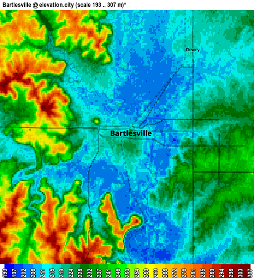
These maps also provides idea of topography and contour of this city, they are displayed at different zoom levels. More info about maps, scale and edge coordinates you can find below images.
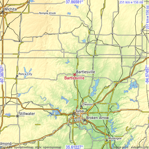
| \ | Map #1 | Map #2 | Topo.Map |
| Scale [m] | 193..290 m | 193..307 m | × |
| Scale [ft] | 633..951 ft | 633..1007 ft | × |
| Average | 214.1 m = 702 ft | 229.6 m = 753 ft | × |
| Width | 7.83 km = 4.9 mi | 15.66 km = 9.7 mi | 250.6 km = 155.7 mi |
| Height | 7.83 km = 4.9 mi | 15.66 km = 9.7 mi | 250.6 km = 155.7 mi |
| ↑Max Latitude | 36.782515° | 36.817703° | 37.86581° |
| Latitude at center | 36.74731° | 36.74731° | 36.74731° |
| ↓Min Latitude | 36.712089° | 36.676853° | 35.61227° |
| ← Min Longitude | -96.024765° | -96.068711° | -97.38707° |
| Longitude center | -95.98082° | -95.98082° | -95.98082° |
| →Max Longitude | -95.936875° | -95.892929° | -94.57457° |
Nearby cities:
Cities around Bartlesville sort by population:
• Coffeyville elevation 227 m
45.7 km,  45°
45°
• Skiatook 198 m
42.2 km,  182°
182°
• Collinsville 198 m
44.4 km,  163°
163°
• Nowata 218 m
31 km,  99°
99°
• Pawhuska 255 m
33 km,  254°
254°
• Hominy 244 m
52.4 km,  224°
224°
• Dewey 217 m
6.7 km,  36°
36°
• Caney 239 m
29.6 km,  7°
7°
• Sperry 193 m
50 km, 181°
• Barnsdall 230 m
26.2 km, 218°
• Oologah 202 m
41.3 km,  143°
143°
• Sedan 265 m
46 km,  336°
336°
Multilingual:
 En español:
Bartlesville elevación 217 m.
 En France:
Bartlesville élévation 217 m.
 Auf Deutsch:
Bartlesville höhe über dem Meeresspiegel ist 217 m.

Sources and notes:
- [note 1] Map square and city borders are not equal. Map elevation data is calculated only from area inside that square.
- [src 1] Elevation data from geonames database provided with same terms of usage.
- [src 2] The elevation map of Bartlesville is generated using elevation data from NASA's 3 arcsec (90m) resolution SRTM data.
- [src 3] Base (background) map © OpenStreetMap contributors tiles are generated by Geofabrik and OpenTopoMap.
Copyright & License:
This Bartlesville Elevation Map is licensed under CC BY-SA. You may reuse any part from this page, if you give a proper credit by linking to this URL:
 More info on terms of use page.