Woodsfield elevation
Woodsfield (Ohio, Monroe County), United States elevation is 367 meters and Woodsfield elevation in feet is 1204 ft above sea level [src 1]. Woodsfield is a seat of a second-order administrative division (feature code) with elevation that is 88 meters (289 ft) bigger than average city elevation in United States.
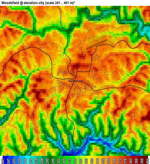
Below is the Elevation map of Woodsfield, which displays elevation range with different colors. Scale of the first map is from 241 to 401 m (791 to 1316 ft) with average elevation of 337.9 meters (=1109 ft) [note 1]
These maps also provides idea of topography and contour of this city, they are displayed at different zoom levels. More info about maps, scale and edge coordinates you can find below images.
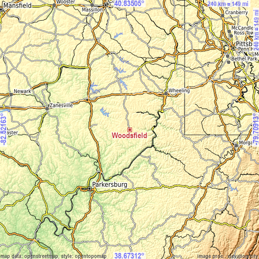
| \ | Map #1 | Topo.Map |
| Scale [m] | 241..401 m | × |
| Scale [ft] | 791..1316 ft | × |
| Average | 337.9 m = 1109 ft | × |
| Width | 7.51 km = 4.7 mi | 240.4 km = 149.4 mi |
| Height | 7.51 km = 4.7 mi | 240.4 km = 149.4 mi |
| ↑Max Latitude | 39.796343° | 40.83505° |
| Latitude at center | 39.76257° | 39.76257° |
| ↓Min Latitude | 39.728781° | 38.67312° |
| ← Min Longitude | -81.159325° | -82.52163° |
| Longitude center | -81.11538° | -81.11538° |
| →Max Longitude | -81.071435° | -79.70913° |
Nearby cities:
Cities around Woodsfield sort by population:
• Moundsville elevation 211 m
36.3 km,  61°
61°
• New Martinsville 192 m
25.7 km,  120°
120°
• Barnesville 390 m
25.6 km,  348°
348°
• Shadyside 208 m
38.8 km,  53°
53°
• Paden City 201 m
23.4 km,  139°
139°
• Caldwell 228 m
34.3 km,  267°
267°
• Powhatan Point 205 m
27.8 km,  67°
67°
• Glendale 210 m
37.2 km, 56°
• Sistersville 198 m
24.3 km,  155°
155°
• Bethesda 374 m
28.4 km,  7°
7°
• New Matamoras 193 m
26.8 km,  171°
171°
• Middlebourne 226 m
35.1 km,  148°
148°
Multilingual:
 En español:
Woodsfield elevación 367 m.
 En France:
Woodsfield élévation 367 m.
 Auf Deutsch:
Woodsfield höhe über dem Meeresspiegel ist 367 m.

Sources and notes:
- [note 1] Map square and city borders are not equal. Map elevation data is calculated only from area inside that square.
- [src 1] Elevation data from geonames database provided with same terms of usage.
- [src 2] The elevation map of Woodsfield is generated using elevation data from NASA's 3 arcsec (90m) resolution SRTM data.
- [src 3] Base (background) map © OpenStreetMap contributors tiles are generated by Geofabrik and OpenTopoMap.
Copyright & License:
This Woodsfield Elevation Map is licensed under CC BY-SA. You may reuse any part from this page, if you give a proper credit by linking to this URL:
 More info on terms of use page.