Trenton elevation
Trenton (Ohio, Butler County), United States elevation is 198 meters and Trenton elevation in feet is 650 ft above sea level [src 1]. Trenton is a populated place (feature code) with elevation that is 81 meters (266 ft) smaller than average city elevation in United States.
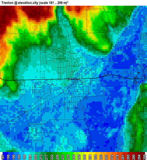
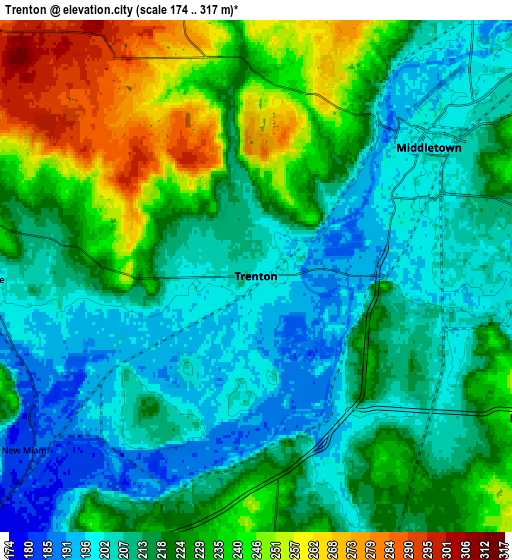
Below is the Elevation map of Trenton, which displays elevation range with different colors. Scale of the first map is from 181 to 299 m (594 to 981 ft) with average elevation of 210.2 meters (=690 ft) [note 1]
These maps also provides idea of topography and contour of this city, they are displayed at different zoom levels. More info about maps, scale and edge coordinates you can find below images.
| \ | Map #1 | Map #2 | Topo.Map |
| Scale [m] | 181..299 m | 174..317 m | × |
| Scale [ft] | 594..981 ft | 571..1040 ft | × |
| Average | 210.2 m = 690 ft | 219.7 m = 721 ft | × |
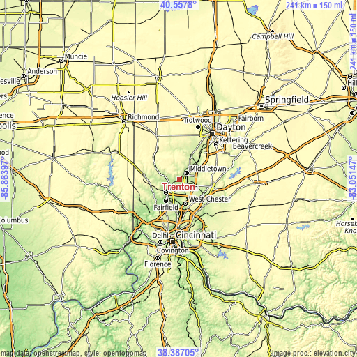
| Width | 7.54 km = 4.7 mi | 15.09 km = 9.4 mi | 241.4 km = 150 mi |
| Height | 7.54 km = 4.7 mi | 15.09 km = 9.4 mi | 241.4 km = 150 mi |
| ↑Max Latitude | 39.5148° | 39.548694° | 40.5578° |
| Latitude at center | 39.48089° | 39.48089° | 39.48089° |
| ↓Min Latitude | 39.446963° | 39.41302° | 38.38705° |
| ← Min Longitude | -84.501665° | -84.545611° | -85.86397° |
| Longitude center | -84.45772° | -84.45772° | -84.45772° |
| →Max Longitude | -84.413775° | -84.369829° | -83.05147° |
Nearby cities:
Cities around Trenton sort by population:
• Hamilton elevation 186 m
12.7 km,  224°
224°
• Middletown 200 m
6.4 km,  53°
53°
• Fairfield 185 m
17.4 km,  210°
210°
• Monroe 253 m
9.4 km,  118°
118°
• Franklin 208 m
15.8 km,  56°
56°
• Beckett Ridge 255 m
15 km,  172°
172°
• Germantown 220 m
17.8 km,  25°
25°
• Carlisle 211 m
16.3 km, 46°
• Mayfield 207 m
7.5 km,  78°
78°
• New Miami 182 m
8.5 km,  232°
232°
• Hunter 270 m
14.5 km, 84°
• Wetherington 261 m
14.7 km,  152°
152°
Multilingual:
 En español:
Trenton elevación 198 m.
 En France:
Trenton élévation 198 m.


Sources and notes:
- [note 1] Map square and city borders are not equal. Map elevation data is calculated only from area inside that square.
- [src 1] Elevation data from geonames database provided with same terms of usage.
- [src 2] The elevation map of Trenton is generated using elevation data from NASA's 3 arcsec (90m) resolution SRTM data.
- [src 3] Base (background) map © OpenStreetMap contributors tiles are generated by Geofabrik and OpenTopoMap.
Copyright & License:
This Trenton Elevation Map is licensed under CC BY-SA. You may reuse any part from this page, if you give a proper credit by linking to this URL:
 More info on terms of use page.