Tipp City elevation
Tipp City (Ohio, Miami County), United States elevation is 252 meters and Tipp City elevation in feet is 827 ft above sea level [src 1]. Tipp City is a populated place (feature code) with elevation that is 27 meters (89 ft) smaller than average city elevation in United States.
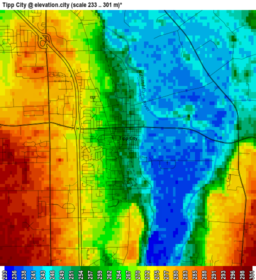
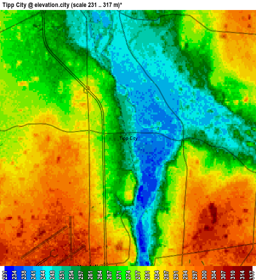
Below is the Elevation map of Tipp City, which displays elevation range with different colors. Scale of the first map is from 233 to 301 m (764 to 988 ft) with average elevation of 263 meters (=863 ft) [note 1]
These maps also provides idea of topography and contour of this city, they are displayed at different zoom levels. More info about maps, scale and edge coordinates you can find below images.
| \ | Map #1 | Map #2 | Topo.Map |
| Scale [m] | 233..301 m | 231..317 m | × |
| Scale [ft] | 764..988 ft | 758..1040 ft | × |
| Average | 263 m = 863 ft | 273.5 m = 897 ft | × |
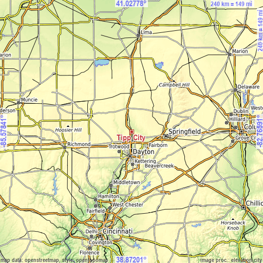
| Width | 7.49 km = 4.7 mi | 14.98 km = 9.3 mi | 239.7 km = 148.9 mi |
| Height | 7.49 km = 4.7 mi | 14.98 km = 9.3 mi | 239.7 km = 148.9 mi |
| ↑Max Latitude | 39.992066° | 40.025726° | 41.02778° |
| Latitude at center | 39.95839° | 39.95839° | 39.95839° |
| ↓Min Latitude | 39.924697° | 39.890988° | 38.87201° |
| ← Min Longitude | -84.216105° | -84.260051° | -85.57841° |
| Longitude center | -84.17216° | -84.17216° | -84.17216° |
| →Max Longitude | -84.128215° | -84.084269° | -82.76591° |
Nearby cities:
Cities around Tipp City sort by population:
• Huber Heights elevation 284 m
13.4 km,  162°
162°
• Troy 257 m
9.4 km,  343°
343°
• Vandalia 304 m
7.9 km,  196°
196°
• Englewood 280 m
14.3 km,  230°
230°
• Shiloh 250 m
16.3 km, 197°
• Northridge 244 m
16.9 km,  187°
187°
• Union 282 m
13.3 km,  239°
239°
• New Carlisle 274 m
12.7 km,  101°
101°
• West Milton 275 m
13.3 km,  271°
271°
• Park Layne 257 m
13.8 km,  125°
125°
• Crystal Lakes 260 m
14.6 km,  121°
121°
• Pleasant Hill 285 m
18 km,  305°
305°
Multilingual:
 En español:
Tipp City elevación 252 m.
 En France:
Tipp City élévation 252 m.
 Auf Deutsch:
Tipp City höhe über dem Meeresspiegel ist 252 m.

Sources and notes:
- [note 1] Map square and city borders are not equal. Map elevation data is calculated only from area inside that square.
- [src 1] Elevation data from geonames database provided with same terms of usage.
- [src 2] The elevation map of Tipp City is generated using elevation data from NASA's 3 arcsec (90m) resolution SRTM data.
- [src 3] Base (background) map © OpenStreetMap contributors tiles are generated by Geofabrik and OpenTopoMap.
Copyright & License:
This Tipp City Elevation Map is licensed under CC BY-SA. You may reuse any part from this page, if you give a proper credit by linking to this URL:
 More info on terms of use page.