Englewood elevation
Englewood (Ohio, Montgomery County), United States elevation is 280 meters and Englewood elevation in feet is 919 ft above sea level [src 1]. Englewood is a populated place (feature code) with elevation that is 1 meters (3 ft) bigger than average city elevation in United States.
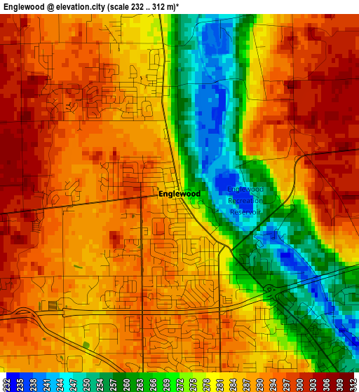
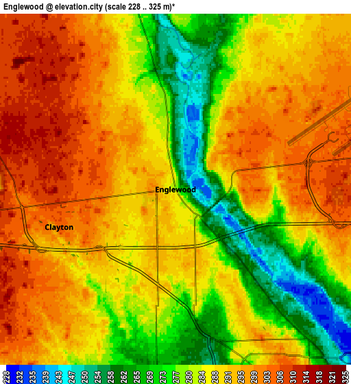
Below is the Elevation map of Englewood, which displays elevation range with different colors. Scale of the first map is from 232 to 312 m (761 to 1024 ft) with average elevation of 283.2 meters (=929 ft) [note 1]
These maps also provides idea of topography and contour of this city, they are displayed at different zoom levels. More info about maps, scale and edge coordinates you can find below images.
| \ | Map #1 | Map #2 | Topo.Map |
| Scale [m] | 232..312 m | 228..325 m | × |
| Scale [ft] | 761..1024 ft | 748..1066 ft | × |
| Average | 283.2 m = 929 ft | 287.5 m = 943 ft | × |
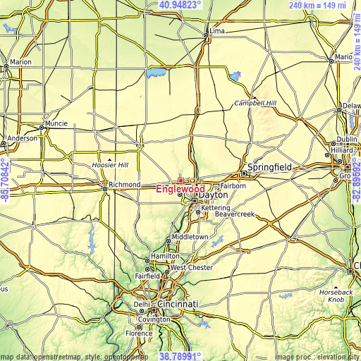
| Width | 7.5 km = 4.7 mi | 15 km = 9.3 mi | 240 km = 149.1 mi |
| Height | 7.5 km = 4.7 mi | 15 km = 9.3 mi | 240 km = 149.1 mi |
| ↑Max Latitude | 39.911276° | 39.944976° | 40.94823° |
| Latitude at center | 39.87756° | 39.87756° | 39.87756° |
| ↓Min Latitude | 39.843827° | 39.810078° | 38.78991° |
| ← Min Longitude | -84.346115° | -84.390061° | -85.70842° |
| Longitude center | -84.30217° | -84.30217° | -84.30217° |
| →Max Longitude | -84.258225° | -84.214279° | -82.89592° |
Nearby cities:
Cities around Englewood sort by population:
• Huber Heights elevation 284 m
15.6 km,  103°
103°
• Trotwood 255 m
9 km,  185°
185°
• Vandalia 304 m
8.9 km,  80°
80°
• Clayton 305 m
5.2 km,  252°
252°
• Shiloh 250 m
9.1 km,  136°
136°
• Tipp City 252 m
14.3 km,  50°
50°
• Northridge 244 m
11.9 km,  130°
130°
• Union 282 m
2.3 km,  351°
351°
• Brookville 313 m
10.4 km,  244°
244°
• West Milton 275 m
9.7 km, 346°
• Fort McKinley 281 m
9.8 km,  154°
154°
• Drexel 289 m
14.6 km,  174°
174°
Multilingual:
 En español:
Englewood elevación 280 m.
 En France:
Englewood élévation 280 m.
 Auf Deutsch:
Englewood höhe über dem Meeresspiegel ist 280 m.

Sources and notes:
- [note 1] Map square and city borders are not equal. Map elevation data is calculated only from area inside that square.
- [src 1] Elevation data from geonames database provided with same terms of usage.
- [src 2] The elevation map of Englewood is generated using elevation data from NASA's 3 arcsec (90m) resolution SRTM data.
- [src 3] Base (background) map © OpenStreetMap contributors tiles are generated by Geofabrik and OpenTopoMap.
Copyright & License:
This Englewood Elevation Map is licensed under CC BY-SA. You may reuse any part from this page, if you give a proper credit by linking to this URL:
 More info on terms of use page.