Ross elevation
Ross (Ohio, Butler County), United States elevation is 169 meters and Ross elevation in feet is 554 ft above sea level [src 1]. Ross is a populated place (feature code) with elevation that is 110 meters (361 ft) smaller than average city elevation in United States.
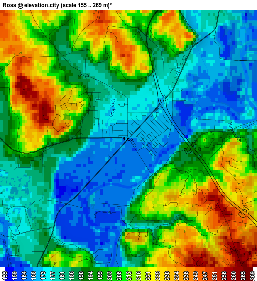
Below is the Elevation map of Ross, which displays elevation range with different colors. Scale of the first map is from 155 to 269 m (509 to 883 ft) with average elevation of 196.7 meters (=645 ft) [note 1]
These maps also provides idea of topography and contour of this city, they are displayed at different zoom levels. More info about maps, scale and edge coordinates you can find below images.
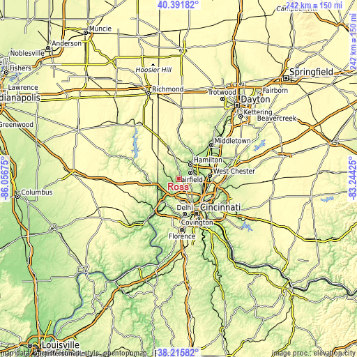
| \ | Map #1 | Topo.Map |
| Scale [m] | 155..269 m | × |
| Scale [ft] | 509..883 ft | × |
| Average | 196.7 m = 645 ft | × |
| Width | 7.56 km = 4.7 mi | 241.9 km = 150.3 mi |
| Height | 7.56 km = 4.7 mi | 241.9 km = 150.3 mi |
| ↑Max Latitude | 39.346272° | 40.39182° |
| Latitude at center | 39.31228° | 39.31228° |
| ↓Min Latitude | 39.278271° | 38.21582° |
| ← Min Longitude | -84.694445° | -86.05675° |
| Longitude center | -84.6505° | -84.6505° |
| →Max Longitude | -84.606555° | -83.24425° |
Nearby cities:
Cities around Ross sort by population:
• Fairfield elevation 185 m
8.6 km,  64°
64°
• Northbrook 255 m
9.3 km,  141°
141°
• Northgate 270 m
8.3 km, 142°
• Groesbeck 262 m
11.3 km,  151°
151°
• New Burlington 250 m
9.9 km,  126°
126°
• Pleasant Run 230 m
7.6 km,  100°
100°
• Pleasant Run Farm 233 m
8.9 km, 96°
• Mount Healthy Heights 260 m
8.5 km,  123°
123°
• Dry Ridge 279 m
6.5 km,  155°
155°
• Dunlap 264 m
3.6 km, 128°
• Skyline Acres 256 m
11.8 km, 142°
• Miamitown 159 m
11.7 km,  203°
203°
Multilingual:
 En español:
Ross elevación 169 m.
 En France:
Ross élévation 169 m.


Sources and notes:
- [note 1] Map square and city borders are not equal. Map elevation data is calculated only from area inside that square.
- [src 1] Elevation data from geonames database provided with same terms of usage.
- [src 2] The elevation map of Ross is generated using elevation data from NASA's 3 arcsec (90m) resolution SRTM data.
- [src 3] Base (background) map © OpenStreetMap contributors tiles are generated by Geofabrik and OpenTopoMap.
Copyright & License:
This Ross Elevation Map is licensed under CC BY-SA. You may reuse any part from this page, if you give a proper credit by linking to this URL:
 More info on terms of use page.