Pleasant Run Farm elevation
Pleasant Run Farm (Ohio, Hamilton County), United States elevation is 233 meters and Pleasant Run Farm elevation in feet is 764 ft above sea level [src 1]. Pleasant Run Farm is a populated place (feature code) with elevation that is 46 meters (151 ft) smaller than average city elevation in United States.
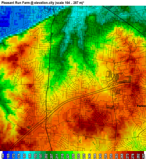
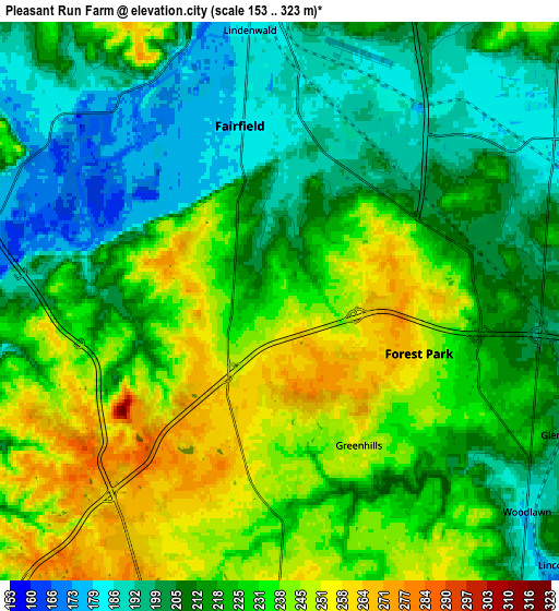
Below is the Elevation map of Pleasant Run Farm, which displays elevation range with different colors. Scale of the first map is from 164 to 287 m (538 to 942 ft) with average elevation of 237.9 meters (=781 ft) [note 1]
These maps also provides idea of topography and contour of this city, they are displayed at different zoom levels. More info about maps, scale and edge coordinates you can find below images.
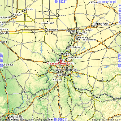
| \ | Map #1 | Map #2 | Topo.Map |
| Scale [m] | 164..287 m | 153..323 m | × |
| Scale [ft] | 538..942 ft | 502..1060 ft | × |
| Average | 237.9 m = 781 ft | 221.3 m = 726 ft | × |
| Width | 7.56 km = 4.7 mi | 15.12 km = 9.4 mi | 242 km = 150.4 mi |
| Height | 7.56 km = 4.7 mi | 15.12 km = 9.4 mi | 242 km = 150.4 mi |
| ↑Max Latitude | 39.337107° | 39.371087° | 40.3828° |
| Latitude at center | 39.30311° | 39.30311° | 39.30311° |
| ↓Min Latitude | 39.269097° | 39.235067° | 38.20651° |
| ← Min Longitude | -84.591945° | -84.635891° | -85.95425° |
| Longitude center | -84.548° | -84.548° | -84.548° |
| →Max Longitude | -84.504055° | -84.460109° | -83.14175° |
Nearby cities:
Cities around Pleasant Run Farm sort by population:
• Fairfield elevation 185 m
4.9 km,  347°
347°
• Forest Park 258 m
4 km,  110°
110°
• Springdale 226 m
5.7 km, 108°
• Northbrook 255 m
7 km,  205°
205°
• Northgate 270 m
6.8 km, 214°
• Mount Healthy 259 m
7.7 km,  178°
178°
• New Burlington 250 m
4.9 km,  189°
189°
• Pleasant Run 230 m
1.4 km,  254°
254°
• Greenhills 249 m
4.4 km,  151°
151°
• Mount Healthy Heights 260 m
4 km, 205°
• Dry Ridge 279 m
7.8 km,  231°
231°
• Dunlap 264 m
6.1 km,  258°
258°
Multilingual:
 En español:
Pleasant Run Farm elevación 233 m.
 En France:
Pleasant Run Farm élévation 233 m.
 Auf Deutsch:
Pleasant Run Farm höhe über dem Meeresspiegel ist 233 m.

Sources and notes:
- [note 1] Map square and city borders are not equal. Map elevation data is calculated only from area inside that square.
- [src 1] Elevation data from geonames database provided with same terms of usage.
- [src 2] The elevation map of Pleasant Run Farm is generated using elevation data from NASA's 3 arcsec (90m) resolution SRTM data.
- [src 3] Base (background) map © OpenStreetMap contributors tiles are generated by Geofabrik and OpenTopoMap.
Copyright & License:
This Pleasant Run Farm Elevation Map is licensed under CC BY-SA. You may reuse any part from this page, if you give a proper credit by linking to this URL:
 More info on terms of use page.