Mason elevation
Mason (Ohio, Warren County), United States elevation is 246 meters and Mason elevation in feet is 807 ft above sea level [src 1]. Mason is a populated place (feature code) with elevation that is 33 meters (108 ft) smaller than average city elevation in United States.
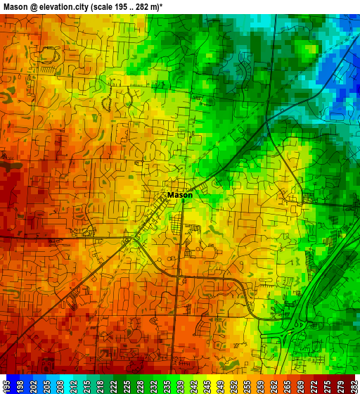
Below is the Elevation map of Mason, which displays elevation range with different colors. Scale of the first map is from 195 to 282 m (640 to 925 ft) with average elevation of 246.8 meters (=810 ft) [note 1]
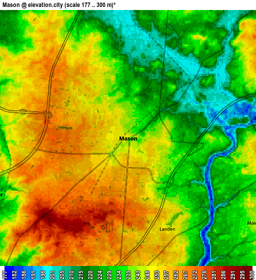
These maps also provides idea of topography and contour of this city, they are displayed at different zoom levels. More info about maps, scale and edge coordinates you can find below images.
| \ | Map #1 | Map #2 | Topo.Map |
| Scale [m] | 195..282 m | 177..300 m | × |
| Scale [ft] | 640..925 ft | 581..984 ft | × |
| Average | 246.8 m = 810 ft | 242.4 m = 795 ft | × |
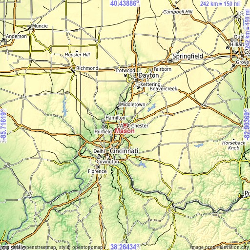
| Width | 7.56 km = 4.7 mi | 15.11 km = 9.4 mi | 241.8 km = 150.2 mi |
| Height | 7.56 km = 4.7 mi | 15.11 km = 9.4 mi | 241.8 km = 150.2 mi |
| ↑Max Latitude | 39.394029° | 39.427982° | 40.43886° |
| Latitude at center | 39.36006° | 39.36006° | 39.36006° |
| ↓Min Latitude | 39.326074° | 39.292072° | 38.26434° |
| ← Min Longitude | -84.353885° | -84.397831° | -85.71619° |
| Longitude center | -84.30994° | -84.30994° | -84.30994° |
| →Max Longitude | -84.265995° | -84.222049° | -82.90369° |
Nearby cities:
Cities around Mason sort by population:
• Lebanon elevation 237 m
12.4 km,  47°
47°
• Sharonville 178 m
13.5 km,  221°
221°
• Monroe 253 m
10 km,  333°
333°
• Loveland 184 m
10.9 km,  158°
158°
• Beckett Ridge 255 m
10.9 km,  262°
262°
• Landen 251 m
5.8 km, 156°
• South Lebanon 191 m
8.4 km,  81°
81°
• Sixteen Mile Stand 246 m
9.8 km,  188°
188°
• Loveland Park 225 m
7.8 km,  149°
149°
• Highpoint 268 m
8.7 km,  203°
203°
• Kings Mills 232 m
5.3 km,  95°
95°
• Wetherington 261 m
5.8 km,  273°
273°
Multilingual:
 En español:
Mason elevación 246 m.
 En France:
Mason élévation 246 m.


Sources and notes:
- [note 1] Map square and city borders are not equal. Map elevation data is calculated only from area inside that square.
- [src 1] Elevation data from geonames database provided with same terms of usage.
- [src 2] The elevation map of Mason is generated using elevation data from NASA's 3 arcsec (90m) resolution SRTM data.
- [src 3] Base (background) map © OpenStreetMap contributors tiles are generated by Geofabrik and OpenTopoMap.
Copyright & License:
This Mason Elevation Map is licensed under CC BY-SA. You may reuse any part from this page, if you give a proper credit by linking to this URL:
 More info on terms of use page.