Georgetown elevation
Georgetown (Ohio, Brown County), United States elevation is 282 meters and Georgetown elevation in feet is 925 ft above sea level [src 1]. Georgetown is a seat of a second-order administrative division (feature code) with elevation that is 3 meters (10 ft) bigger than average city elevation in United States.
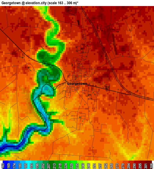
Below is the Elevation map of Georgetown, which displays elevation range with different colors. Scale of the first map is from 163 to 306 m (535 to 1004 ft) with average elevation of 270.3 meters (=887 ft) [note 1]
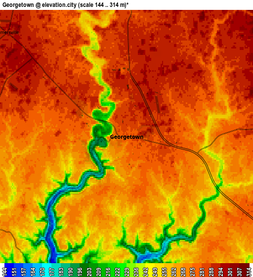
These maps also provides idea of topography and contour of this city, they are displayed at different zoom levels. More info about maps, scale and edge coordinates you can find below images.
| \ | Map #1 | Map #2 | Topo.Map |
| Scale [m] | 163..306 m | 144..314 m | × |
| Scale [ft] | 535..1004 ft | 472..1030 ft | × |
| Average | 270.3 m = 887 ft | 269.1 m = 883 ft | × |
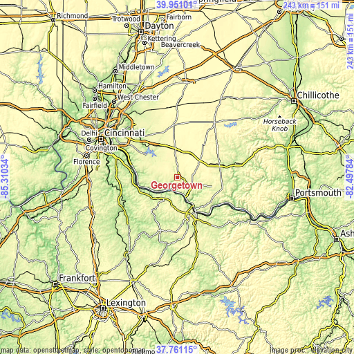
| Width | 7.61 km = 4.7 mi | 15.22 km = 9.5 mi | 243.5 km = 151.3 mi |
| Height | 7.61 km = 4.7 mi | 15.22 km = 9.5 mi | 243.5 km = 151.3 mi |
| ↑Max Latitude | 38.898719° | 38.932912° | 39.95101° |
| Latitude at center | 38.86451° | 38.86451° | 38.86451° |
| ↓Min Latitude | 38.830285° | 38.796043° | 37.76115° |
| ← Min Longitude | -83.948035° | -83.991981° | -85.31034° |
| Longitude center | -83.90409° | -83.90409° | -83.90409° |
| →Max Longitude | -83.860145° | -83.816199° | -82.49784° |
Nearby cities:
Cities around Georgetown sort by population:
• Maysville elevation 162 m
28.4 km,  150°
150°
• Amelia 269 m
32.7 km,  303°
303°
• Mount Orab 287 m
18.2 km,  355°
355°
• West Union 288 m
32 km,  104°
104°
• Bethel 271 m
18.8 km,  305°
305°
• Williamsburg 249 m
24.7 km,  328°
328°
• Manchester 155 m
32.2 km,  127°
127°
• Ripley 155 m
14.2 km,  158°
158°
• Aberdeen 156 m
26.3 km, 151°
• Augusta 160 m
13.6 km,  220°
220°
• Winchester 296 m
23.5 km,  68°
68°
• Brooksville 287 m
24.6 km,  214°
214°
Multilingual:
 En español:
Georgetown elevación 282 m.
 En France:
Georgetown élévation 282 m.
 Auf Deutsch:
Georgetown höhe über dem Meeresspiegel ist 282 m.

Sources and notes:
- [note 1] Map square and city borders are not equal. Map elevation data is calculated only from area inside that square.
- [src 1] Elevation data from geonames database provided with same terms of usage.
- [src 2] The elevation map of Georgetown is generated using elevation data from NASA's 3 arcsec (90m) resolution SRTM data.
- [src 3] Base (background) map © OpenStreetMap contributors tiles are generated by Geofabrik and OpenTopoMap.
Copyright & License:
This Georgetown Elevation Map is licensed under CC BY-SA. You may reuse any part from this page, if you give a proper credit by linking to this URL:
 More info on terms of use page.