Roanoke Rapids elevation
Roanoke Rapids (North Carolina, Halifax County), United States elevation is 51 meters and Roanoke Rapids elevation in feet is 167 ft above sea level [src 1]. Roanoke Rapids is a populated place (feature code) with elevation that is 228 meters (748 ft) smaller than average city elevation in United States.
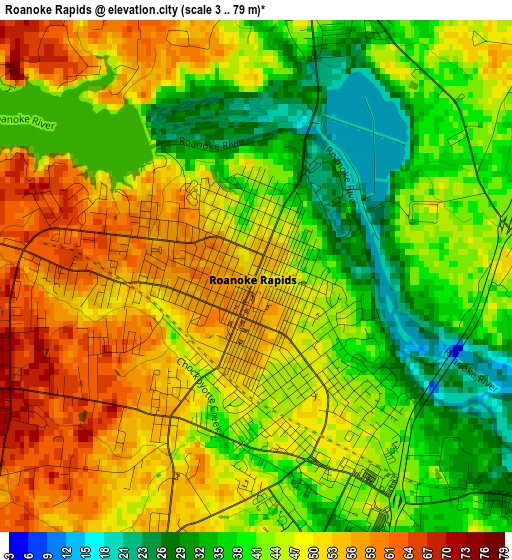
Below is the Elevation map of Roanoke Rapids, which displays elevation range with different colors. Scale of the first map is from 3 to 79 m (10 to 259 ft) with average elevation of 45.3 meters (=149 ft) [note 1]
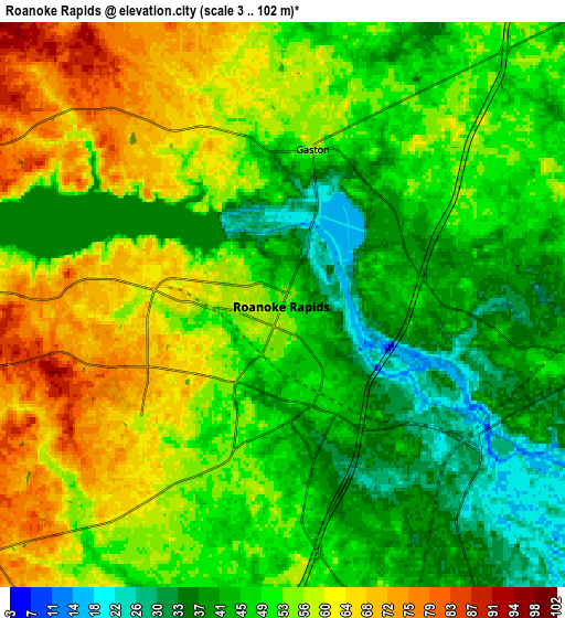
These maps also provides idea of topography and contour of this city, they are displayed at different zoom levels. More info about maps, scale and edge coordinates you can find below images.
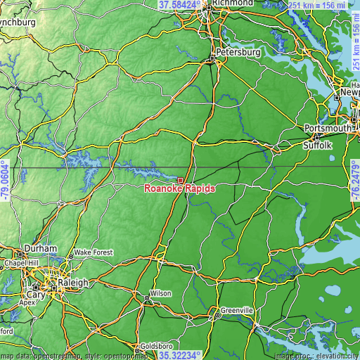
| \ | Map #1 | Map #2 | Topo.Map |
| Scale [m] | 3..79 m | 3..102 m | × |
| Scale [ft] | 10..259 ft | 10..335 ft | × |
| Average | 45.3 m = 149 ft | 51.3 m = 168 ft | × |
| Width | 7.86 km = 4.9 mi | 15.72 km = 9.8 mi | 251.5 km = 156.3 mi |
| Height | 7.86 km = 4.9 mi | 15.72 km = 9.8 mi | 251.5 km = 156.3 mi |
| ↑Max Latitude | 36.496875° | 36.532194° | 37.58424° |
| Latitude at center | 36.46154° | 36.46154° | 36.46154° |
| ↓Min Latitude | 36.426189° | 36.390821° | 35.32234° |
| ← Min Longitude | -77.698095° | -77.742041° | -79.0604° |
| Longitude center | -77.65415° | -77.65415° | -77.65415° |
| →Max Longitude | -77.610205° | -77.566259° | -76.2479° |
Nearby cities:
Cities around Roanoke Rapids sort by population:
• Emporia elevation 40 m
26.9 km,  21°
21°
• South Rosemary 72 m
4 km,  253°
253°
• Enfield 35 m
31.2 km,  182°
182°
• Scotland Neck 37 m
42.4 km,  150°
150°
• Weldon 24 m
6.5 km,  126°
126°
• Bracey 111 m
46.3 km,  289°
289°
• Norlina 130 m
48.7 km,  267°
267°
• Lawrenceville 76 m
37.1 km,  332°
332°
• Gaston 58 m
4.4 km,  10°
10°
• Warrenton 118 m
45.4 km,  261°
261°
• Jackson 36 m
22.3 km,  111°
111°
• Halifax 41 m
15.9 km,  158°
158°
Multilingual:
 En español:
Roanoke Rapids elevación 51 m.
 En France:
Roanoke Rapids élévation 51 m.
 Auf Deutsch:
Roanoke Rapids höhe über dem Meeresspiegel ist 51 m.

Sources and notes:
- [note 1] Map square and city borders are not equal. Map elevation data is calculated only from area inside that square.
- [src 1] Elevation data from geonames database provided with same terms of usage.
- [src 2] The elevation map of Roanoke Rapids is generated using elevation data from NASA's 3 arcsec (90m) resolution SRTM data.
- [src 3] Base (background) map © OpenStreetMap contributors tiles are generated by Geofabrik and OpenTopoMap.
Copyright & License:
This Roanoke Rapids Elevation Map is licensed under CC BY-SA. You may reuse any part from this page, if you give a proper credit by linking to this URL:
 More info on terms of use page.