Red Springs elevation
Red Springs (North Carolina, Robeson County), United States elevation is 62 meters and Red Springs elevation in feet is 203 ft above sea level [src 1]. Red Springs is a populated place (feature code) with elevation that is 217 meters (712 ft) smaller than average city elevation in United States.
Below is the Elevation map of Red Springs, which displays elevation range with different colors. Scale of the first map is from 44 to 78 m (144 to 256 ft) with average elevation of 61 meters (=200 ft) [note 1]
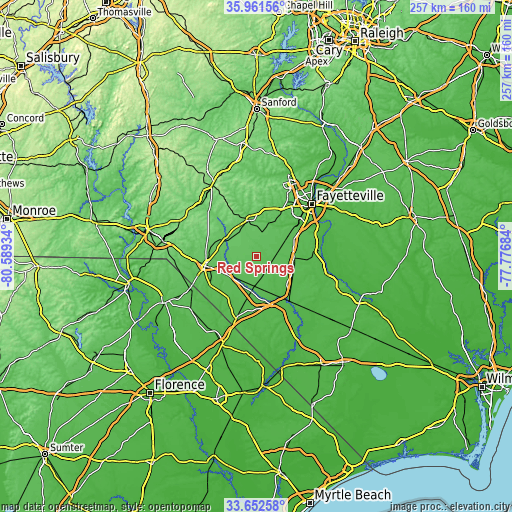
These maps also provides idea of topography and contour of this city, they are displayed at different zoom levels. More info about maps, scale and edge coordinates you can find below images.
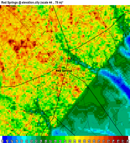
| \ | Map #1 | Topo.Map |
| Scale [m] | 44..78 m | × |
| Scale [ft] | 144..256 ft | × |
| Average | 61 m = 200 ft | × |
| Width | 8.02 km = 5 mi | 256.7 km = 159.5 mi |
| Height | 8.02 km = 5 mi | 256.7 km = 159.5 mi |
| ↑Max Latitude | 34.851231° | 35.96156° |
| Latitude at center | 34.81516° | 34.81516° |
| ↓Min Latitude | 34.779073° | 33.65258° |
| ← Min Longitude | -79.227035° | -80.58934° |
| Longitude center | -79.18309° | -79.18309° |
| →Max Longitude | -79.139145° | -77.77684° |
Nearby cities:
Cities around Red Springs sort by population:
• Lumberton elevation 29 m
27 km,  144°
144°
• Hope Mills 36 m
27.7 km,  51°
51°
• Laurinburg 69 m
25.9 km,  259°
259°
• Raeford 83 m
18.8 km,  348°
348°
• Rockfish 68 m
22.4 km,  28°
28°
• Pembroke 47 m
15.1 km,  184°
184°
• Fairmont 33 m
36 km,  169°
169°
• Maxton 61 m
17.6 km,  239°
239°
• McColl 59 m
36.9 km, 243°
• Saint Pauls 53 m
19.4 km,  92°
92°
• Laurel Hill 76 m
33.3 km,  268°
268°
• Rowland 40 m
32.5 km,  197°
197°
Multilingual:
 En español:
Red Springs elevación 62 m.
 En France:
Red Springs élévation 62 m.
 Auf Deutsch:
Red Springs höhe über dem Meeresspiegel ist 62 m.

Sources and notes:
- [note 1] Map square and city borders are not equal. Map elevation data is calculated only from area inside that square.
- [src 1] Elevation data from geonames database provided with same terms of usage.
- [src 2] The elevation map of Red Springs is generated using elevation data from NASA's 3 arcsec (90m) resolution SRTM data.
- [src 3] Base (background) map © OpenStreetMap contributors tiles are generated by Geofabrik and OpenTopoMap.
Copyright & License:
This Red Springs Elevation Map is licensed under CC BY-SA. You may reuse any part from this page, if you give a proper credit by linking to this URL:
 More info on terms of use page.