Forest elevation
Forest (Mississippi, Scott County), United States elevation is 149 meters and Forest elevation in feet is 489 ft above sea level [src 1]. Forest is a seat of a second-order administrative division (feature code) with elevation that is 130 meters (427 ft) smaller than average city elevation in United States.
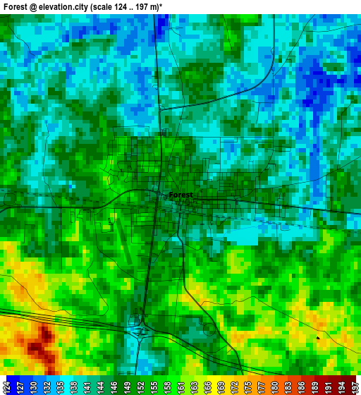
Below is the Elevation map of Forest, which displays elevation range with different colors. Scale of the first map is from 124 to 197 m (407 to 646 ft) with average elevation of 147.9 meters (=485 ft) [note 1]
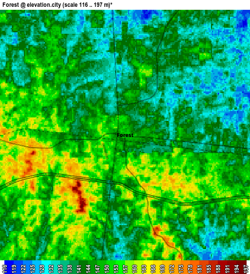
These maps also provides idea of topography and contour of this city, they are displayed at different zoom levels. More info about maps, scale and edge coordinates you can find below images.
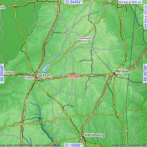
| \ | Map #1 | Map #2 | Topo.Map |
| Scale [m] | 124..197 m | 116..197 m | × |
| Scale [ft] | 407..646 ft | 381..646 ft | × |
| Average | 147.9 m = 485 ft | 145.7 m = 478 ft | × |
| Width | 8.25 km = 5.1 mi | 16.51 km = 10.3 mi | 264.1 km = 164.1 mi |
| Height | 8.25 km = 5.1 mi | 16.51 km = 10.3 mi | 264.1 km = 164.1 mi |
| ↑Max Latitude | 32.401701° | 32.438797° | 33.54454° |
| Latitude at center | 32.36459° | 32.36459° | 32.36459° |
| ↓Min Latitude | 32.327464° | 32.290322° | 31.16904° |
| ← Min Longitude | -89.518175° | -89.562121° | -90.88048° |
| Longitude center | -89.47423° | -89.47423° | -89.47423° |
| →Max Longitude | -89.430285° | -89.386339° | -88.06798° |
Nearby cities:
Cities around Forest sort by population:
• Carthage elevation 108 m
41.3 km,  351°
351°
• Morton 152 m
17 km,  265°
265°
• Newton 130 m
29.6 km,  99°
99°
• Union 151 m
40.3 km,  55°
55°
• Decatur 135 m
35.3 km,  76°
76°
• Bay Springs 130 m
46.3 km,  157°
157°
• Walnut Grove 110 m
25.2 km,  3°
3°
• Coldwater 145 m
45.9 km,  32°
32°
• Raleigh 165 m
37.1 km,  187°
187°
• Pelahatchie 114 m
31 km,  259°
259°
• Conehatta 154 m
20.2 km, 61°
• Hillsboro 136 m
11.1 km,  341°
341°
Multilingual:
 En español:
Forest elevación 149 m.
 En France:
Forest élévation 149 m.


Sources and notes:
- [note 1] Map square and city borders are not equal. Map elevation data is calculated only from area inside that square.
- [src 1] Elevation data from geonames database provided with same terms of usage.
- [src 2] The elevation map of Forest is generated using elevation data from NASA's 3 arcsec (90m) resolution SRTM data.
- [src 3] Base (background) map © OpenStreetMap contributors tiles are generated by Geofabrik and OpenTopoMap.
Copyright & License:
This Forest Elevation Map is licensed under CC BY-SA. You may reuse any part from this page, if you give a proper credit by linking to this URL:
 More info on terms of use page.