Batesville elevation
Batesville (Mississippi, Panola County), United States elevation is 76 meters and Batesville elevation in feet is 249 ft above sea level [src 1]. Batesville is a populated place (feature code) with elevation that is 203 meters (666 ft) smaller than average city elevation in United States.
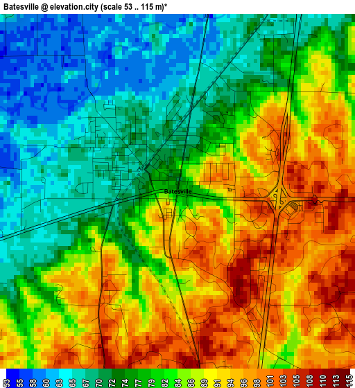
Below is the Elevation map of Batesville, which displays elevation range with different colors. Scale of the first map is from 53 to 115 m (174 to 377 ft) with average elevation of 82 meters (=269 ft) [note 1]
These maps also provides idea of topography and contour of this city, they are displayed at different zoom levels. More info about maps, scale and edge coordinates you can find below images.
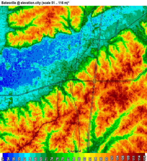
| \ | Map #1 | Map #2 | Topo.Map |
| Scale [m] | 53..115 m | 51..116 m | × |
| Scale [ft] | 174..377 ft | 167..381 ft | × |
| Average | 82 m = 269 ft | 83.8 m = 275 ft | × |
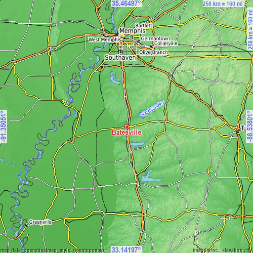
| Width | 8.07 km = 5 mi | 16.14 km = 10 mi | 258.3 km = 160.5 mi |
| Height | 8.07 km = 5 mi | 16.14 km = 10 mi | 258.3 km = 160.5 mi |
| ↑Max Latitude | 34.34779° | 34.384065° | 35.46497° |
| Latitude at center | 34.3115° | 34.3115° | 34.3115° |
| ↓Min Latitude | 34.275194° | 34.238872° | 33.14197° |
| ← Min Longitude | -89.988205° | -90.032151° | -91.35051° |
| Longitude center | -89.94426° | -89.94426° | -89.94426° |
| →Max Longitude | -89.900315° | -89.856369° | -88.53801° |
Nearby cities:
Cities around Batesville sort by population:
• Oxford elevation 155 m
39.5 km,  81°
81°
• Senatobia 87 m
34.1 km,  356°
356°
• University 152 m
38.9 km, 81°
• Water Valley 90 m
33.8 km,  121°
121°
• Charleston 62 m
35.4 km,  196°
196°
• Sardis 117 m
14.2 km,  10°
10°
• Coldwater 79 m
42.4 km, 355°
• Marks 49 m
30.8 km,  258°
258°
• Lambert 48 m
33.5 km,  248°
248°
• Como 112 m
22.1 km,  1°
1°
• Jonestown 51 m
47 km,  271°
271°
• Mikoma 45 m
50.9 km,  217°
217°
Multilingual:
 En español:
Batesville elevación 76 m.
 En France:
Batesville élévation 76 m.
 Auf Deutsch:
Batesville höhe über dem Meeresspiegel ist 76 m.

Sources and notes:
- [note 1] Map square and city borders are not equal. Map elevation data is calculated only from area inside that square.
- [src 1] Elevation data from geonames database provided with same terms of usage.
- [src 2] The elevation map of Batesville is generated using elevation data from NASA's 3 arcsec (90m) resolution SRTM data.
- [src 3] Base (background) map © OpenStreetMap contributors tiles are generated by Geofabrik and OpenTopoMap.
Copyright & License:
This Batesville Elevation Map is licensed under CC BY-SA. You may reuse any part from this page, if you give a proper credit by linking to this URL:
 More info on terms of use page.