Knob Noster elevation
Knob Noster (Missouri, Johnson County), United States elevation is 245 meters and Knob Noster elevation in feet is 804 ft above sea level [src 1]. Knob Noster is a populated place (feature code) with elevation that is 34 meters (112 ft) smaller than average city elevation in United States.
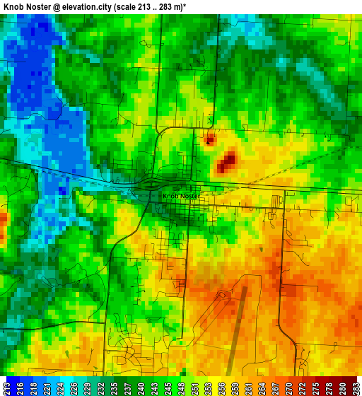
Below is the Elevation map of Knob Noster, which displays elevation range with different colors. Scale of the first map is from 213 to 283 m (699 to 928 ft) with average elevation of 246.2 meters (=808 ft) [note 1]
These maps also provides idea of topography and contour of this city, they are displayed at different zoom levels. More info about maps, scale and edge coordinates you can find below images.
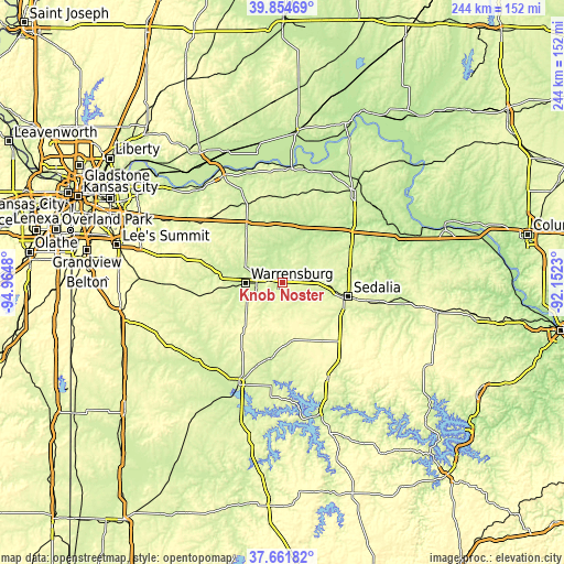
| \ | Map #1 | Topo.Map |
| Scale [m] | 213..283 m | × |
| Scale [ft] | 699..928 ft | × |
| Average | 246.2 m = 808 ft | × |
| Width | 7.62 km = 4.7 mi | 243.8 km = 151.5 mi |
| Height | 7.62 km = 4.7 mi | 243.8 km = 151.5 mi |
| ↑Max Latitude | 38.800936° | 39.85469° |
| Latitude at center | 38.76668° | 38.76668° |
| ↓Min Latitude | 38.732408° | 37.66182° |
| ← Min Longitude | -93.602495° | -94.9648° |
| Longitude center | -93.55855° | -93.55855° |
| →Max Longitude | -93.514605° | -92.1523° |
Nearby cities:
Cities around Knob Noster sort by population:
• Sedalia elevation 282 m
29.5 km,  103°
103°
• Warrensburg 270 m
15.4 km,  268°
268°
• Odessa 288 m
42.9 km,  307°
307°
• Higginsville 252 m
36.7 km,  338°
338°
• Windsor 284 m
26.3 km,  173°
173°
• Whiteman Air Force Base 260 m
4.1 km,  180°
180°
• Concordia 243 m
24.1 km,  357°
357°
• Holden 263 m
38 km,  261°
261°
• Sweet Springs 223 m
25.2 km,  29°
29°
• Lincoln 296 m
46.1 km,  155°
155°
• La Monte 263 m
11.6 km,  85°
85°
• Cole Camp 325 m
46 km,  137°
137°
Multilingual:
 En español:
Knob Noster elevación 245 m.
 En France:
Knob Noster élévation 245 m.
 Auf Deutsch:
Knob Noster höhe über dem Meeresspiegel ist 245 m.

Sources and notes:
- [note 1] Map square and city borders are not equal. Map elevation data is calculated only from area inside that square.
- [src 1] Elevation data from geonames database provided with same terms of usage.
- [src 2] The elevation map of Knob Noster is generated using elevation data from NASA's 3 arcsec (90m) resolution SRTM data.
- [src 3] Base (background) map © OpenStreetMap contributors tiles are generated by Geofabrik and OpenTopoMap.
Copyright & License:
This Knob Noster Elevation Map is licensed under CC BY-SA. You may reuse any part from this page, if you give a proper credit by linking to this URL:
 More info on terms of use page.