Takoma Park elevation
Takoma Park (Maryland, Montgomery County), United States elevation is 89 meters and Takoma Park elevation in feet is 292 ft above sea level [src 1]. Takoma Park is a populated place (feature code) with elevation that is 190 meters (623 ft) smaller than average city elevation in United States.
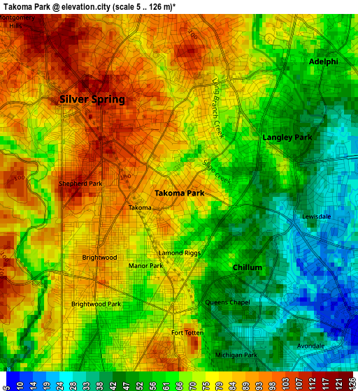
Below is the Elevation map of Takoma Park, which displays elevation range with different colors. Scale of the first map is from 5 to 126 m (16 to 413 ft) with average elevation of 69.8 meters (=229 ft) [note 1]
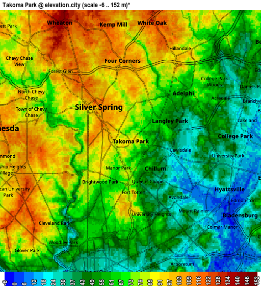
These maps also provides idea of topography and contour of this city, they are displayed at different zoom levels. More info about maps, scale and edge coordinates you can find below images.
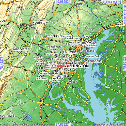
| \ | Map #1 | Map #2 | Topo.Map |
| Scale [m] | 5..126 m | -6..152 m | × |
| Scale [ft] | 16..413 ft | -20..499 ft | × |
| Average | 69.8 m = 229 ft | 67.9 m = 223 ft | × |
| Width | 7.6 km = 4.7 mi | 15.19 km = 9.4 mi | 243.1 km = 151.1 mi |
| Height | 7.6 km = 4.7 mi | 15.19 km = 9.4 mi | 243.1 km = 151.1 mi |
| ↑Max Latitude | 39.012044° | 39.046182° | 40.06263° |
| Latitude at center | 38.97789° | 38.97789° | 38.97789° |
| ↓Min Latitude | 38.943719° | 38.909532° | 37.87627° |
| ← Min Longitude | -77.051425° | -77.095371° | -78.41373° |
| Longitude center | -77.00748° | -77.00748° | -77.00748° |
| →Max Longitude | -76.963535° | -76.919589° | -75.60123° |
Nearby cities:
Cities around Takoma Park sort by population:
• Silver Spring elevation 106 m
2.1 km,  311°
311°
• Chillum 48 m
2.1 km,  137°
137°
• Langley Park 49 m
2.6 km,  61°
61°
• Hyattsville 37 m
5.9 km,  114°
114°
• Adelphi 56 m
4.2 km,  47°
47°
• Chevy Chase 108 m
5.4 km,  253°
253°
• Mount Rainier 29 m
5.5 km, 137°
• Four Corners 106 m
4.7 km,  354°
354°
• Forest Glen 94 m
5.8 km, 314°
• Hillandale 88 m
6.1 km,  28°
28°
• Brentwood 8 m
5.9 km,  131°
131°
• University Park 28 m
5.7 km,  98°
98°
Multilingual:
 En español:
Takoma Park elevación 89 m.
 En France:
Takoma Park élévation 89 m.
 Auf Deutsch:
Takoma Park höhe über dem Meeresspiegel ist 89 m.

Sources and notes:
- [note 1] Map square and city borders are not equal. Map elevation data is calculated only from area inside that square.
- [src 1] Elevation data from geonames database provided with same terms of usage.
- [src 2] The elevation map of Takoma Park is generated using elevation data from NASA's 3 arcsec (90m) resolution SRTM data.
- [src 3] Base (background) map © OpenStreetMap contributors tiles are generated by Geofabrik and OpenTopoMap.
Copyright & License:
This Takoma Park Elevation Map is licensed under CC BY-SA. You may reuse any part from this page, if you give a proper credit by linking to this URL:
 More info on terms of use page.