Pikesville elevation
Pikesville (Maryland, Baltimore County), United States elevation is 153 meters and Pikesville elevation in feet is 502 ft above sea level [src 1]. Pikesville is a populated place (feature code) with elevation that is 126 meters (413 ft) smaller than average city elevation in United States.
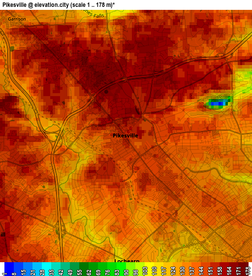
Below is the Elevation map of Pikesville, which displays elevation range with different colors. Scale of the first map is from 1 to 178 m (3 to 584 ft) with average elevation of 143.1 meters (=469 ft) [note 1]
These maps also provides idea of topography and contour of this city, they are displayed at different zoom levels. More info about maps, scale and edge coordinates you can find below images.
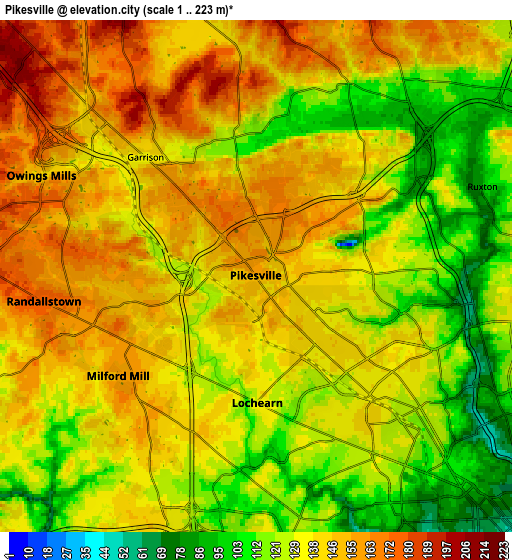
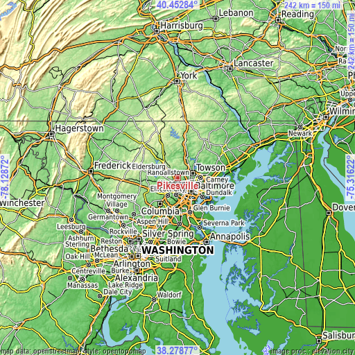
| \ | Map #1 | Map #2 | Topo.Map |
| Scale [m] | 1..178 m | 1..223 m | × |
| Scale [ft] | 3..584 ft | 3..732 ft | × |
| Average | 143.1 m = 469 ft | 135.3 m = 444 ft | × |
| Width | 7.55 km = 4.7 mi | 15.11 km = 9.4 mi | 241.7 km = 150.2 mi |
| Height | 7.55 km = 4.7 mi | 15.11 km = 9.4 mi | 241.7 km = 150.2 mi |
| ↑Max Latitude | 39.408232° | 39.442178° | 40.45284° |
| Latitude at center | 39.37427° | 39.37427° | 39.37427° |
| ↓Min Latitude | 39.340291° | 39.306296° | 38.27877° |
| ← Min Longitude | -76.766415° | -76.810361° | -78.12872° |
| Longitude center | -76.72247° | -76.72247° | -76.72247° |
| →Max Longitude | -76.678525° | -76.634579° | -75.31622° |
Nearby cities:
Cities around Pikesville sort by population:
• Towson elevation 148 m
10.8 km,  73°
73°
• Woodlawn 104 m
5.7 km,  184°
184°
• Randallstown 175 m
6.3 km,  262°
262°
• Owings Mills 152 m
7.1 km,  315°
315°
• Milford Mill 155 m
5 km,  234°
234°
• Lochearn 128 m
3.7 km, 179°
• Mays Chapel 154 m
9.1 km,  43°
43°
• Garrison 136 m
4.8 km, 317°
• Charles Village 68 m
11 km,  121°
121°
• Lutherville 128 m
9.8 km,  57°
57°
• Irvington 73 m
10.6 km,  162°
162°
• Arlington 135 m
4.4 km,  130°
130°
Multilingual:
 En español:
Pikesville elevación 153 m.
 En France:
Pikesville élévation 153 m.
 Auf Deutsch:
Pikesville höhe über dem Meeresspiegel ist 153 m.

Sources and notes:
- [note 1] Map square and city borders are not equal. Map elevation data is calculated only from area inside that square.
- [src 1] Elevation data from geonames database provided with same terms of usage.
- [src 2] The elevation map of Pikesville is generated using elevation data from NASA's 3 arcsec (90m) resolution SRTM data.
- [src 3] Base (background) map © OpenStreetMap contributors tiles are generated by Geofabrik and OpenTopoMap.
Copyright & License:
This Pikesville Elevation Map is licensed under CC BY-SA. You may reuse any part from this page, if you give a proper credit by linking to this URL:
 More info on terms of use page.