Charlestown elevation
Charlestown (Maryland, Cecil County), United States elevation is 8 meters and Charlestown elevation in feet is 26 ft above sea level [src 1]. Charlestown is a populated place (feature code) with elevation that is 271 meters (889 ft) smaller than average city elevation in United States.
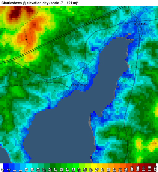
Below is the Elevation map of Charlestown, which displays elevation range with different colors. Scale of the first map is from -7 to 121 m (-23 to 397 ft) with average elevation of 32.7 meters (=107 ft) [note 1]
These maps also provides idea of topography and contour of this city, they are displayed at different zoom levels. More info about maps, scale and edge coordinates you can find below images.
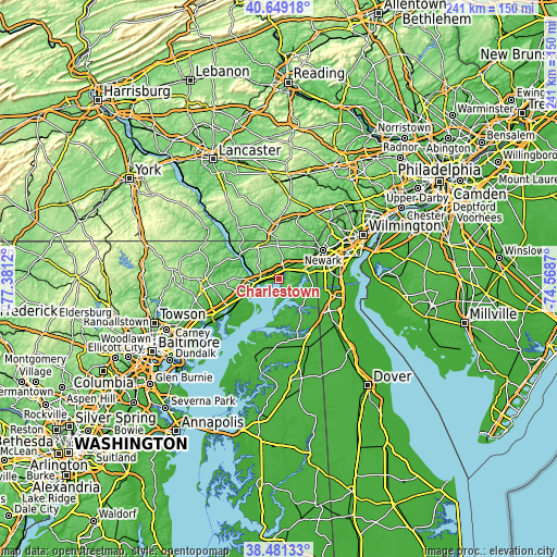
| \ | Map #1 | Topo.Map |
| Scale [m] | -7..121 m | × |
| Scale [ft] | -23..397 ft | × |
| Average | 32.7 m = 107 ft | × |
| Width | 7.53 km = 4.7 mi | 241 km = 149.8 mi |
| Height | 7.53 km = 4.7 mi | 241 km = 149.8 mi |
| ↑Max Latitude | 39.607595° | 40.64918° |
| Latitude at center | 39.57373° | 39.57373° |
| ↓Min Latitude | 39.539848° | 38.48133° |
| ← Min Longitude | -76.018895° | -77.3812° |
| Longitude center | -75.97495° | -75.97495° |
| →Max Longitude | -75.931005° | -74.5687° |
Nearby cities:
Cities around Charlestown sort by population:
• Newark elevation 39 m
22.8 km,  57°
57°
• Elkton 8 m
12.7 km,  73°
73°
• Aberdeen 25 m
17.7 km,  246°
246°
• Brookside 25 m
23.6 km, 63°
• Glasgow 21 m
20 km,  80°
80°
• Havre de Grace 14 m
10.4 km, 254°
• Oxford 172 m
23.5 km,  359°
359°
• Perryville 14 m
8.4 km,  259°
259°
• North East 5 m
4.1 km,  44°
44°
• Rising Sun 119 m
15.7 km,  331°
331°
• Perryman 15 m
22.8 km,  239°
239°
• Aberdeen Proving Ground 9 m
17.9 km,  228°
228°
Multilingual:
 En español:
Charlestown elevación 8 m.
 En France:
Charlestown élévation 8 m.
 Auf Deutsch:
Charlestown höhe über dem Meeresspiegel ist 8 m.

Sources and notes:
- [note 1] Map square and city borders are not equal. Map elevation data is calculated only from area inside that square.
- [src 1] Elevation data from geonames database provided with same terms of usage.
- [src 2] The elevation map of Charlestown is generated using elevation data from NASA's 3 arcsec (90m) resolution SRTM data.
- [src 3] Base (background) map © OpenStreetMap contributors tiles are generated by Geofabrik and OpenTopoMap.
Copyright & License:
This Charlestown Elevation Map is licensed under CC BY-SA. You may reuse any part from this page, if you give a proper credit by linking to this URL:
 More info on terms of use page.