Tallulah elevation
Tallulah (Louisiana, Madison Parish), United States elevation is 30 meters and Tallulah elevation in feet is 98 ft above sea level [src 1]. Tallulah is a seat of a second-order administrative division (feature code) with elevation that is 249 meters (817 ft) smaller than average city elevation in United States.
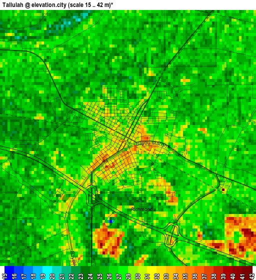
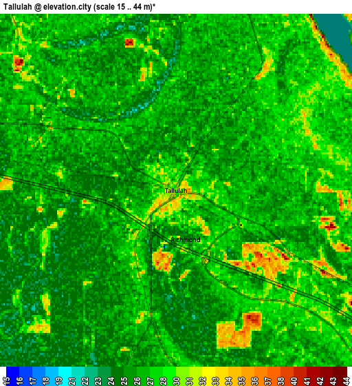
Below is the Elevation map of Tallulah, which displays elevation range with different colors. Scale of the first map is from 15 to 42 m (49 to 138 ft) with average elevation of 27.3 meters (=90 ft) [note 1]
These maps also provides idea of topography and contour of this city, they are displayed at different zoom levels. More info about maps, scale and edge coordinates you can find below images.
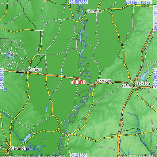
| \ | Map #1 | Map #2 | Topo.Map |
| Scale [m] | 15..42 m | 15..44 m | × |
| Scale [ft] | 49..138 ft | 49..144 ft | × |
| Average | 27.3 m = 90 ft | 27.1 m = 89 ft | × |
| Width | 8.25 km = 5.1 mi | 16.5 km = 10.3 mi | 264 km = 164 mi |
| Height | 8.25 km = 5.1 mi | 16.5 km = 10.3 mi | 264 km = 164 mi |
| ↑Max Latitude | 32.445573° | 32.482651° | 33.58785° |
| Latitude at center | 32.40848° | 32.40848° | 32.40848° |
| ↓Min Latitude | 32.371372° | 32.334248° | 31.2135° |
| ← Min Longitude | -91.230725° | -91.274671° | -92.59303° |
| Longitude center | -91.18678° | -91.18678° | -91.18678° |
| →Max Longitude | -91.142835° | -91.098889° | -89.78053° |
Nearby cities:
Cities around Tallulah sort by population:
• Vicksburg elevation 78 m
29.7 km,  102°
102°
• Monticello 29 m
28.5 km,  317°
317°
• Lake Providence 30 m
44.1 km,  1°
1°
• Rayville 26 m
53.9 km,  278°
278°
• Beechwood 66 m
35 km, 104°
• Delhi 34 m
29.3 km, 280°
• Oak Grove 40 m
53.7 km,  339°
339°
• Port Gibson 39 m
53.3 km,  159°
159°
• Saint Joseph 26 m
54.7 km,  184°
184°
• Newellton 29 m
37.7 km,  187°
187°
• Edwards 72 m
55.3 km, 99°
• Mayersville 36 m
56.3 km,  13°
13°
Multilingual:
 En español:
Tallulah elevación 30 m.
 En France:
Tallulah élévation 30 m.


Sources and notes:
- [note 1] Map square and city borders are not equal. Map elevation data is calculated only from area inside that square.
- [src 1] Elevation data from geonames database provided with same terms of usage.
- [src 2] The elevation map of Tallulah is generated using elevation data from NASA's 3 arcsec (90m) resolution SRTM data.
- [src 3] Base (background) map © OpenStreetMap contributors tiles are generated by Geofabrik and OpenTopoMap.
Copyright & License:
This Tallulah Elevation Map is licensed under CC BY-SA. You may reuse any part from this page, if you give a proper credit by linking to this URL:
 More info on terms of use page.