Grambling elevation
Grambling (Louisiana, Lincoln Parish), United States elevation is 98 meters and Grambling elevation in feet is 322 ft above sea level [src 1]. Grambling is a populated place (feature code) with elevation that is 181 meters (594 ft) smaller than average city elevation in United States.
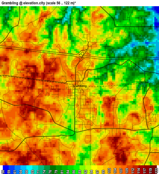
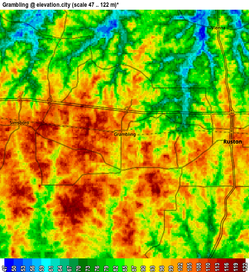
Below is the Elevation map of Grambling, which displays elevation range with different colors. Scale of the first map is from 56 to 122 m (184 to 400 ft) with average elevation of 96.4 meters (=316 ft) [note 1]
These maps also provides idea of topography and contour of this city, they are displayed at different zoom levels. More info about maps, scale and edge coordinates you can find below images.
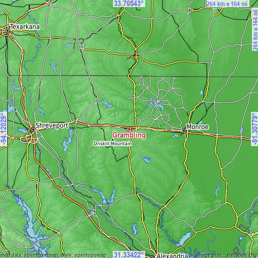
| \ | Map #1 | Map #2 | Topo.Map |
| Scale [m] | 56..122 m | 47..122 m | × |
| Scale [ft] | 184..400 ft | 154..400 ft | × |
| Average | 96.4 m = 316 ft | 90.1 m = 296 ft | × |
| Width | 8.24 km = 5.1 mi | 16.48 km = 10.2 mi | 263.7 km = 163.9 mi |
| Height | 8.24 km = 5.1 mi | 16.48 km = 10.2 mi | 263.7 km = 163.9 mi |
| ↑Max Latitude | 32.564694° | 32.601723° | 33.70543° |
| Latitude at center | 32.52765° | 32.52765° | 32.52765° |
| ↓Min Latitude | 32.490591° | 32.453516° | 31.33422° |
| ← Min Longitude | -92.757985° | -92.801931° | -94.12029° |
| Longitude center | -92.71404° | -92.71404° | -92.71404° |
| →Max Longitude | -92.670095° | -92.626149° | -91.30779° |
Nearby cities:
Cities around Grambling sort by population:
• Ruston elevation 104 m
7.2 km,  93°
93°
• West Monroe 30 m
53.1 km, 91°
• Minden 82 m
54.6 km,  280°
280°
• Claiborne 52 m
49 km, 91°
• Jonesboro 72 m
31.8 km,  180°
180°
• Brownsville 23 m
52.7 km, 94°
• Farmerville 56 m
39.8 km,  46°
46°
• Bawcomville 31 m
51.7 km,  97°
97°
• Homer 72 m
43.4 km,  312°
312°
• Arcadia 122 m
19.5 km, 277°
• Bernice 70 m
33.2 km,  9°
9°
• Sibley 68 m
54.6 km,  271°
271°
Multilingual:
 En español:
Grambling elevación 98 m.
 En France:
Grambling élévation 98 m.
 Auf Deutsch:
Grambling höhe über dem Meeresspiegel ist 98 m.

Sources and notes:
- [note 1] Map square and city borders are not equal. Map elevation data is calculated only from area inside that square.
- [src 1] Elevation data from geonames database provided with same terms of usage.
- [src 2] The elevation map of Grambling is generated using elevation data from NASA's 3 arcsec (90m) resolution SRTM data.
- [src 3] Base (background) map © OpenStreetMap contributors tiles are generated by Geofabrik and OpenTopoMap.
Copyright & License:
This Grambling Elevation Map is licensed under CC BY-SA. You may reuse any part from this page, if you give a proper credit by linking to this URL:
 More info on terms of use page.