Bogalusa elevation
Bogalusa (Louisiana, Washington Parish), United States elevation is 39 meters and Bogalusa elevation in feet is 128 ft above sea level [src 1]. Bogalusa is a populated place (feature code) with elevation that is 240 meters (787 ft) smaller than average city elevation in United States.
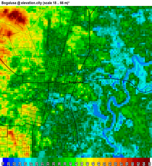
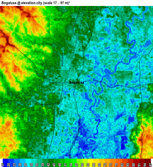
Below is the Elevation map of Bogalusa, which displays elevation range with different colors. Scale of the first map is from 18 to 66 m (59 to 217 ft) with average elevation of 36.1 meters (=118 ft) [note 1]
These maps also provides idea of topography and contour of this city, they are displayed at different zoom levels. More info about maps, scale and edge coordinates you can find below images.
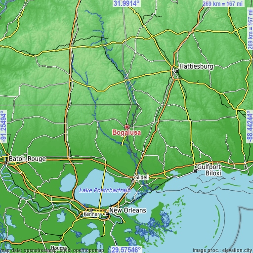
| \ | Map #1 | Map #2 | Topo.Map |
| Scale [m] | 18..66 m | 17..97 m | × |
| Scale [ft] | 59..217 ft | 56..318 ft | × |
| Average | 36.1 m = 118 ft | 42.1 m = 138 ft | × |
| Width | 8.39 km = 5.2 mi | 16.79 km = 10.4 mi | 268.6 km = 166.9 mi |
| Height | 8.39 km = 5.2 mi | 16.79 km = 10.4 mi | 268.6 km = 166.9 mi |
| ↑Max Latitude | 30.828763° | 30.866492° | 31.9914° |
| Latitude at center | 30.79102° | 30.79102° | 30.79102° |
| ↓Min Latitude | 30.753262° | 30.715489° | 29.57546° |
| ← Min Longitude | -89.892635° | -89.936581° | -91.25494° |
| Longitude center | -89.84869° | -89.84869° | -89.84869° |
| →Max Longitude | -89.804745° | -89.760799° | -88.44244° |
Nearby cities:
Cities around Bogalusa sort by population:
• Carriere elevation 56 m
27 km,  135°
135°
• Picayune 23 m
33.7 km,  151°
151°
• Covington 12 m
42.6 km,  214°
214°
• Columbia 48 m
51.2 km,  1°
1°
• Franklinton 48 m
29.9 km,  282°
282°
• Nicholson 15 m
37.9 km,  156°
156°
• Poplarville 99 m
30.5 km,  79°
79°
• Pearl River 14 m
47.1 km,  168°
168°
• Abita Springs 21 m
39.3 km, 207°
• Lumberton 92 m
44.5 km,  58°
58°
• Hide-A-Way Lake 41 m
32.1 km, 141°
• Tylertown 91 m
45.7 km,  322°
322°
Multilingual:
 En español:
Bogalusa elevación 39 m.
 En France:
Bogalusa élévation 39 m.


Sources and notes:
- [note 1] Map square and city borders are not equal. Map elevation data is calculated only from area inside that square.
- [src 1] Elevation data from geonames database provided with same terms of usage.
- [src 2] The elevation map of Bogalusa is generated using elevation data from NASA's 3 arcsec (90m) resolution SRTM data.
- [src 3] Base (background) map © OpenStreetMap contributors tiles are generated by Geofabrik and OpenTopoMap.
Copyright & License:
This Bogalusa Elevation Map is licensed under CC BY-SA. You may reuse any part from this page, if you give a proper credit by linking to this URL:
 More info on terms of use page.