Saint Matthews elevation
Saint Matthews (Kentucky, Jefferson County), United States elevation is 168 meters and Saint Matthews elevation in feet is 551 ft above sea level [src 1]. Saint Matthews is a populated place (feature code) with elevation that is 111 meters (364 ft) smaller than average city elevation in United States.
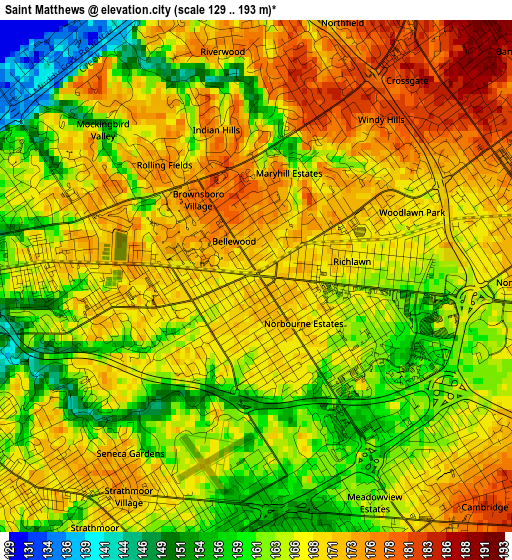
Below is the Elevation map of Saint Matthews, which displays elevation range with different colors. Scale of the first map is from 129 to 193 m (423 to 633 ft) with average elevation of 166.6 meters (=547 ft) [note 1]
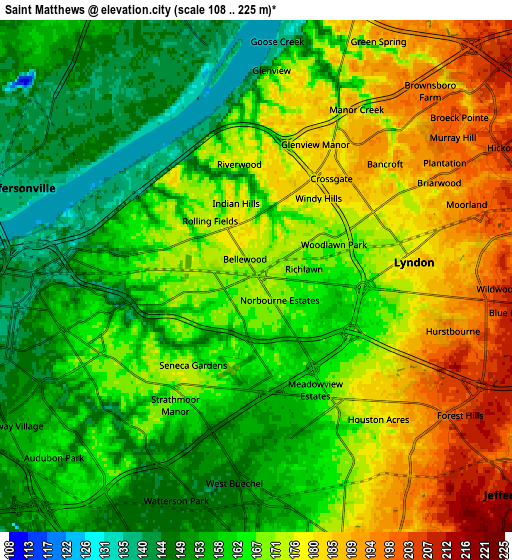
These maps also provides idea of topography and contour of this city, they are displayed at different zoom levels. More info about maps, scale and edge coordinates you can find below images.
| \ | Map #1 | Map #2 | Topo.Map |
| Scale [m] | 129..193 m | 108..225 m | × |
| Scale [ft] | 423..633 ft | 354..738 ft | × |
| Average | 166.6 m = 547 ft | 166.5 m = 546 ft | × |
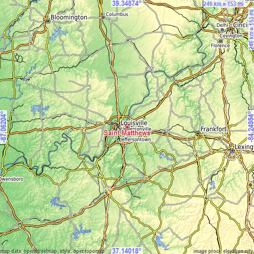
| Width | 7.67 km = 4.8 mi | 15.35 km = 9.5 mi | 245.6 km = 152.6 mi |
| Height | 7.67 km = 4.8 mi | 15.35 km = 9.5 mi | 245.6 km = 152.6 mi |
| ↑Max Latitude | 38.287351° | 38.321837° | 39.34874° |
| Latitude at center | 38.25285° | 38.25285° | 38.25285° |
| ↓Min Latitude | 38.218332° | 38.183798° | 37.14018° |
| ← Min Longitude | -85.699735° | -85.743681° | -87.06204° |
| Longitude center | -85.65579° | -85.65579° | -85.65579° |
| →Max Longitude | -85.611845° | -85.567899° | -84.24954° |
Nearby cities:
Cities around Saint Matthews sort by population:
• Lyndon elevation 180 m
4.7 km,  84°
84°
• Buechel 153 m
6.4 km,  176°
176°
• Hurstbourne 194 m
6.1 km,  105°
105°
• Indian Hills 170 m
2.3 km,  344°
344°
• Graymoor-Devondale 185 m
3.6 km,  51°
51°
• Windy Hills 181 m
3 km,  38°
38°
• Saint Regis Park 176 m
4.5 km,  130°
130°
• Beechwood Village 167 m
2.1 km, 84°
• West Buechel 147 m
6.2 km,  186°
186°
• Barbourmeade 195 m
6.7 km, 42°
• Northfield 181 m
4 km,  18°
18°
• Indian Hills Cherokee Section 184 m
3 km,  9°
9°
Multilingual:
 En español:
Saint Matthews elevación 168 m.
 En France:
Saint Matthews élévation 168 m.
 Auf Deutsch:
Saint Matthews höhe über dem Meeresspiegel ist 168 m.

Sources and notes:
- [note 1] Map square and city borders are not equal. Map elevation data is calculated only from area inside that square.
- [src 1] Elevation data from geonames database provided with same terms of usage.
- [src 2] The elevation map of Saint Matthews is generated using elevation data from NASA's 3 arcsec (90m) resolution SRTM data.
- [src 3] Base (background) map © OpenStreetMap contributors tiles are generated by Geofabrik and OpenTopoMap.
Copyright & License:
This Saint Matthews Elevation Map is licensed under CC BY-SA. You may reuse any part from this page, if you give a proper credit by linking to this URL:
 More info on terms of use page.