Okolona elevation
Okolona (Kentucky, Jefferson County), United States elevation is 145 meters and Okolona elevation in feet is 476 ft above sea level [src 1]. Okolona is a populated place (feature code) with elevation that is 134 meters (440 ft) smaller than average city elevation in United States.
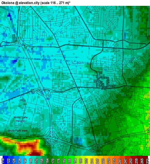
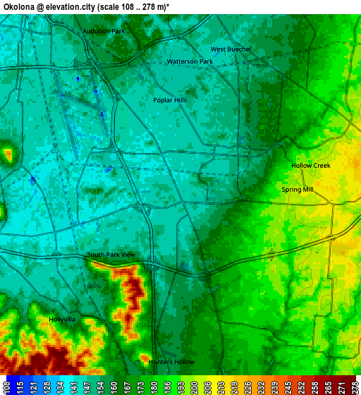
Below is the Elevation map of Okolona, which displays elevation range with different colors. Scale of the first map is from 116 to 271 m (381 to 889 ft) with average elevation of 154.3 meters (=506 ft) [note 1]
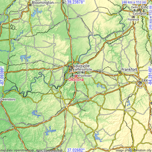
These maps also provides idea of topography and contour of this city, they are displayed at different zoom levels. More info about maps, scale and edge coordinates you can find below images.
| \ | Map #1 | Map #2 | Topo.Map |
| Scale [m] | 116..271 m | 108..278 m | × |
| Scale [ft] | 381..889 ft | 354..912 ft | × |
| Average | 154.3 m = 506 ft | 166.3 m = 546 ft | × |
| Width | 7.69 km = 4.8 mi | 15.37 km = 9.6 mi | 245.9 km = 152.8 mi |
| Height | 7.69 km = 4.8 mi | 15.37 km = 9.6 mi | 245.9 km = 152.8 mi |
| ↑Max Latitude | 38.175734° | 38.210272° | 39.23878° |
| Latitude at center | 38.14118° | 38.14118° | 38.14118° |
| ↓Min Latitude | 38.106609° | 38.072022° | 37.02682° |
| ← Min Longitude | -85.731685° | -85.775631° | -87.09399° |
| Longitude center | -85.68774° | -85.68774° | -85.68774° |
| →Max Longitude | -85.643795° | -85.599849° | -84.28149° |
Nearby cities:
Cities around Okolona sort by population:
• Newburg elevation 149 m
3.2 km,  49°
49°
• Fern Creek 221 m
9 km,  76°
76°
• Highview 208 m
5.6 km,  88°
88°
• Fairdale 145 m
7.4 km,  237°
237°
• Hillview 167 m
7.9 km,  178°
178°
• Buechel 153 m
6.8 km,  27°
27°
• Pioneer Village 167 m
9 km,  174°
174°
• Brooks 158 m
9.1 km,  192°
192°
• Audubon Park 166 m
7.7 km,  334°
334°
• West Buechel 147 m
6.6 km,  18°
18°
• Heritage Creek 146 m
3.4 km, 235°
• Watterson Park 144 m
5.7 km,  3°
3°
Multilingual:
 En español:
Okolona elevación 145 m.
 En France:
Okolona élévation 145 m.


Sources and notes:
- [note 1] Map square and city borders are not equal. Map elevation data is calculated only from area inside that square.
- [src 1] Elevation data from geonames database provided with same terms of usage.
- [src 2] The elevation map of Okolona is generated using elevation data from NASA's 3 arcsec (90m) resolution SRTM data.
- [src 3] Base (background) map © OpenStreetMap contributors tiles are generated by Geofabrik and OpenTopoMap.
Copyright & License:
This Okolona Elevation Map is licensed under CC BY-SA. You may reuse any part from this page, if you give a proper credit by linking to this URL:
 More info on terms of use page.