Elizabethtown elevation
Elizabethtown (Kentucky, Hardin County), United States elevation is 222 meters and Elizabethtown elevation in feet is 728 ft above sea level [src 1]. Elizabethtown is a seat of a second-order administrative division (feature code) with elevation that is 57 meters (187 ft) smaller than average city elevation in United States.
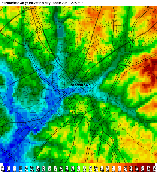
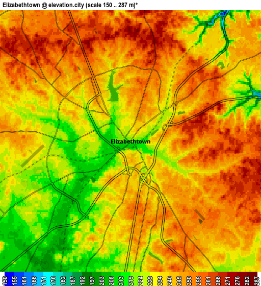
Below is the Elevation map of Elizabethtown, which displays elevation range with different colors. Scale of the first map is from 203 to 275 m (666 to 902 ft) with average elevation of 233.6 meters (=766 ft) [note 1]
These maps also provides idea of topography and contour of this city, they are displayed at different zoom levels. More info about maps, scale and edge coordinates you can find below images.
| \ | Map #1 | Map #2 | Topo.Map |
| Scale [m] | 203..275 m | 150..287 m | × |
| Scale [ft] | 666..902 ft | 492..942 ft | × |
| Average | 233.6 m = 766 ft | 239.4 m = 785 ft | × |
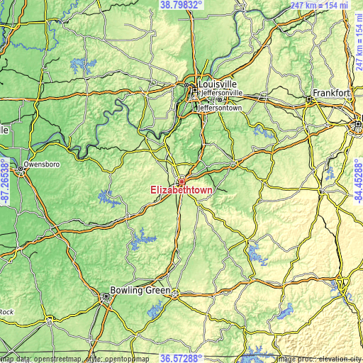
| Width | 7.73 km = 4.8 mi | 15.47 km = 9.6 mi | 247.4 km = 153.7 mi |
| Height | 7.73 km = 4.8 mi | 15.47 km = 9.6 mi | 247.4 km = 153.7 mi |
| ↑Max Latitude | 37.728715° | 37.763464° | 38.79832° |
| Latitude at center | 37.69395° | 37.69395° | 37.69395° |
| ↓Min Latitude | 37.659168° | 37.624371° | 36.57288° |
| ← Min Longitude | -85.903075° | -85.947021° | -87.26538° |
| Longitude center | -85.85913° | -85.85913° | -85.85913° |
| →Max Longitude | -85.815185° | -85.771239° | -84.45288° |
Nearby cities:
Cities around Elizabethtown sort by population:
• Radcliff elevation 236 m
18.1 km,  334°
334°
• Bardstown 201 m
36.8 km,  69°
69°
• Shepherdsville 137 m
35.1 km,  21°
21°
• Fort Knox 224 m
23.8 km,  337°
337°
• Vine Grove 210 m
16.8 km,  320°
320°
• Hodgenville 222 m
17 km,  141°
141°
• Brandenburg 171 m
43.5 km, 321°
• Brooks 158 m
42.9 km, 17°
• Doe Valley 188 m
36.9 km, 322°
• Lebanon Junction 141 m
19.2 km,  35°
35°
• Irvington 192 m
42.7 km,  299°
299°
• Hebron Estates 158 m
43 km, 23°
Multilingual:
 En español:
Elizabethtown elevación 222 m.
 En France:
Elizabethtown élévation 222 m.
 Auf Deutsch:
Elizabethtown höhe über dem Meeresspiegel ist 222 m.

Sources and notes:
- [note 1] Map square and city borders are not equal. Map elevation data is calculated only from area inside that square.
- [src 1] Elevation data from geonames database provided with same terms of usage.
- [src 2] The elevation map of Elizabethtown is generated using elevation data from NASA's 3 arcsec (90m) resolution SRTM data.
- [src 3] Base (background) map © OpenStreetMap contributors tiles are generated by Geofabrik and OpenTopoMap.
Copyright & License:
This Elizabethtown Elevation Map is licensed under CC BY-SA. You may reuse any part from this page, if you give a proper credit by linking to this URL:
 More info on terms of use page.