Sandoval elevation
Sandoval (Illinois, Marion County), United States elevation is 154 meters and Sandoval elevation in feet is 505 ft above sea level [src 1]. Sandoval is a populated place (feature code) with elevation that is 125 meters (410 ft) smaller than average city elevation in United States.
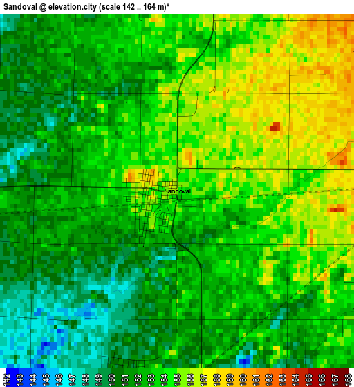
Below is the Elevation map of Sandoval, which displays elevation range with different colors. Scale of the first map is from 142 to 164 m (466 to 538 ft) with average elevation of 152.7 meters (=501 ft) [note 1]
These maps also provides idea of topography and contour of this city, they are displayed at different zoom levels. More info about maps, scale and edge coordinates you can find below images.
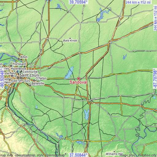
| \ | Map #1 | Topo.Map |
| Scale [m] | 142..164 m | × |
| Scale [ft] | 466..538 ft | × |
| Average | 152.7 m = 501 ft | × |
| Width | 7.64 km = 4.7 mi | 244.3 km = 151.8 mi |
| Height | 7.64 km = 4.7 mi | 244.3 km = 151.8 mi |
| ↑Max Latitude | 38.649928° | 39.70594° |
| Latitude at center | 38.6156° | 38.6156° |
| ↓Min Latitude | 38.581255° | 37.50844° |
| ← Min Longitude | -89.158175° | -90.52048° |
| Longitude center | -89.11423° | -89.11423° |
| →Max Longitude | -89.070285° | -87.70798° |
Nearby cities:
Cities around Sandoval sort by population:
• Mount Vernon elevation 155 m
37.9 km,  151°
151°
• Centralia 151 m
10.2 km,  189°
189°
• Salem 165 m
14.7 km,  85°
85°
• Vandalia 161 m
38.4 km,  2°
2°
• Breese 139 m
35.9 km,  269°
269°
• Carlyle 137 m
22.5 km, 268°
• Nashville 158 m
38.1 km,  217°
217°
• Germantown 133 m
37.5 km,  259°
259°
• Wamac 154 m
12.1 km, 190°
• Central City 149 m
7.5 km, 188°
• Odin 160 m
5.4 km, 88°
• Beckemeyer 140 m
28 km, 267°
Multilingual:
 En español:
Sandoval elevación 154 m.
 En France:
Sandoval élévation 154 m.
 Auf Deutsch:
Sandoval höhe über dem Meeresspiegel ist 154 m.

Sources and notes:
- [note 1] Map square and city borders are not equal. Map elevation data is calculated only from area inside that square.
- [src 1] Elevation data from geonames database provided with same terms of usage.
- [src 2] The elevation map of Sandoval is generated using elevation data from NASA's 3 arcsec (90m) resolution SRTM data.
- [src 3] Base (background) map © OpenStreetMap contributors tiles are generated by Geofabrik and OpenTopoMap.
Copyright & License:
This Sandoval Elevation Map is licensed under CC BY-SA. You may reuse any part from this page, if you give a proper credit by linking to this URL:
 More info on terms of use page.