Valdosta elevation
Valdosta (Georgia, Lowndes County), United States elevation is 71 meters and Valdosta elevation in feet is 233 ft above sea level [src 1]. Valdosta is a seat of a second-order administrative division (feature code) with elevation that is 208 meters (682 ft) smaller than average city elevation in United States.
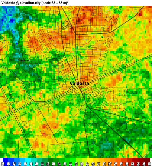
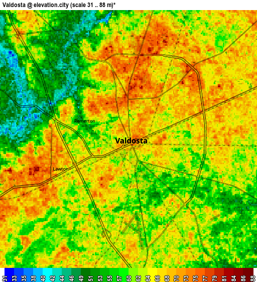
Below is the Elevation map of Valdosta, which displays elevation range with different colors. Scale of the first map is from 38 to 88 m (125 to 289 ft) with average elevation of 64.5 meters (=212 ft) [note 1]
These maps also provides idea of topography and contour of this city, they are displayed at different zoom levels. More info about maps, scale and edge coordinates you can find below images.
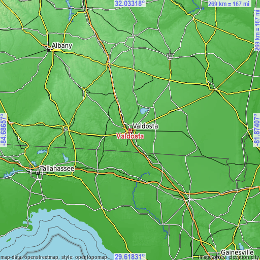
| \ | Map #1 | Map #2 | Topo.Map |
| Scale [m] | 38..88 m | 31..88 m | × |
| Scale [ft] | 125..289 ft | 102..289 ft | × |
| Average | 64.5 m = 212 ft | 62.7 m = 206 ft | × |
| Width | 8.39 km = 5.2 mi | 16.78 km = 10.4 mi | 268.5 km = 166.8 mi |
| Height | 8.39 km = 5.2 mi | 16.78 km = 10.4 mi | 268.5 km = 166.8 mi |
| ↑Max Latitude | 30.871067° | 30.908779° | 32.03318° |
| Latitude at center | 30.83334° | 30.83334° | 30.83334° |
| ↓Min Latitude | 30.795598° | 30.757842° | 29.61831° |
| ← Min Longitude | -83.324265° | -83.368211° | -84.68657° |
| Longitude center | -83.28032° | -83.28032° | -83.28032° |
| →Max Longitude | -83.236375° | -83.192429° | -81.87407° |
Nearby cities:
Cities around Valdosta sort by population:
• Adel elevation 75 m
36.5 km,  337°
337°
• Nashville 77 m
41.7 km,  3°
3°
• Jasper 49 m
47.3 km,  137°
137°
• Quitman 63 m
27.2 km,  258°
258°
• Lakeland 64 m
30.3 km,  40°
40°
• Hahira 72 m
19.6 km,  333°
333°
• Madison 61 m
42.4 km,  197°
197°
• Sparks 77 m
40 km, 338°
• Boston 68 m
48.9 km, 264°
• Remerton 55 m
3.1 km,  292°
292°
• Ray City 61 m
27.9 km,  16°
16°
• Statenville 48 m
28.1 km,  120°
120°
Multilingual:
 En español:
Valdosta elevación 71 m.
 En France:
Valdosta élévation 71 m.


Sources and notes:
- [note 1] Map square and city borders are not equal. Map elevation data is calculated only from area inside that square.
- [src 1] Elevation data from geonames database provided with same terms of usage.
- [src 2] The elevation map of Valdosta is generated using elevation data from NASA's 3 arcsec (90m) resolution SRTM data.
- [src 3] Base (background) map © OpenStreetMap contributors tiles are generated by Geofabrik and OpenTopoMap.
Copyright & License:
This Valdosta Elevation Map is licensed under CC BY-SA. You may reuse any part from this page, if you give a proper credit by linking to this URL:
 More info on terms of use page.