Madison elevation
Madison (Florida, Madison County), United States elevation is 61 meters and Madison elevation in feet is 200 ft above sea level [src 1]. Madison is a seat of a second-order administrative division (feature code) with elevation that is 218 meters (715 ft) smaller than average city elevation in United States.
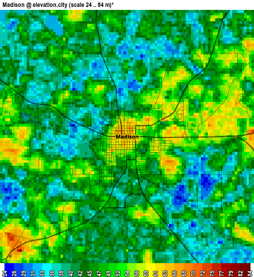
Below is the Elevation map of Madison, which displays elevation range with different colors. Scale of the first map is from 24 to 84 m (79 to 276 ft) with average elevation of 45.1 meters (=148 ft) [note 1]
These maps also provides idea of topography and contour of this city, they are displayed at different zoom levels. More info about maps, scale and edge coordinates you can find below images.
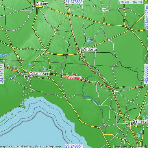
| \ | Map #1 | Topo.Map |
| Scale [m] | 24..84 m | × |
| Scale [ft] | 79..276 ft | × |
| Average | 45.1 m = 148 ft | × |
| Width | 8.42 km = 5.2 mi | 269.5 km = 167.5 mi |
| Height | 8.42 km = 5.2 mi | 269.5 km = 167.5 mi |
| ↑Max Latitude | 30.507249° | 31.67383° |
| Latitude at center | 30.46938° | 30.46938° |
| ↓Min Latitude | 30.431496° | 29.24985° |
| ← Min Longitude | -83.456875° | -84.81918° |
| Longitude center | -83.41293° | -83.41293° |
| →Max Longitude | -83.368985° | -82.00668° |
Nearby cities:
Cities around Madison sort by population:
• Valdosta elevation 71 m
42.4 km,  17°
17°
• Perry 19 m
42.4 km,  202°
202°
• Live Oak 36 m
45.5 km,  115°
115°
• Jasper 49 m
44.9 km,  83°
83°
• Quitman 63 m
37.8 km,  338°
338°
• Hahira 72 m
58.2 km,  3°
3°
• Wellborn 62 m
62.8 km,  114°
114°
• Monticello 76 m
44.7 km,  280°
280°
• Boston 68 m
50.9 km,  314°
314°
• Mayo 29 m
51.6 km,  153°
153°
• Remerton 55 m
42.8 km,  13°
13°
• Statenville 48 m
45.1 km,  54°
54°
Multilingual:
 En español:
Madison elevación 61 m.
 En France:
Madison élévation 61 m.


Sources and notes:
- [note 1] Map square and city borders are not equal. Map elevation data is calculated only from area inside that square.
- [src 1] Elevation data from geonames database provided with same terms of usage.
- [src 2] The elevation map of Madison is generated using elevation data from NASA's 3 arcsec (90m) resolution SRTM data.
- [src 3] Base (background) map © OpenStreetMap contributors tiles are generated by Geofabrik and OpenTopoMap.
Copyright & License:
This Madison Elevation Map is licensed under CC BY-SA. You may reuse any part from this page, if you give a proper credit by linking to this URL:
 More info on terms of use page.