Hazlehurst elevation
Hazlehurst (Georgia, Jeff Davis County), United States elevation is 80 meters and Hazlehurst elevation in feet is 262 ft above sea level [src 1]. Hazlehurst is a seat of a second-order administrative division (feature code) with elevation that is 199 meters (653 ft) smaller than average city elevation in United States.
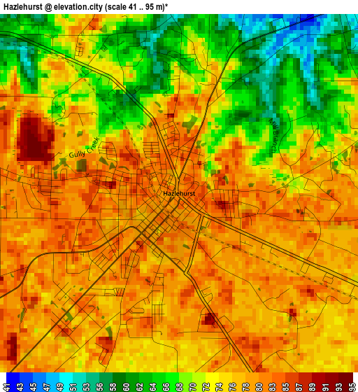
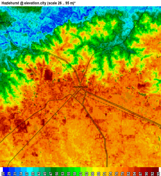
Below is the Elevation map of Hazlehurst, which displays elevation range with different colors. Scale of the first map is from 41 to 95 m (135 to 312 ft) with average elevation of 75.1 meters (=246 ft) [note 1]
These maps also provides idea of topography and contour of this city, they are displayed at different zoom levels. More info about maps, scale and edge coordinates you can find below images.
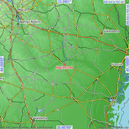
| \ | Map #1 | Map #2 | Topo.Map |
| Scale [m] | 41..95 m | 26..95 m | × |
| Scale [ft] | 135..312 ft | 85..312 ft | × |
| Average | 75.1 m = 246 ft | 67.4 m = 221 ft | × |
| Width | 8.3 km = 5.2 mi | 16.6 km = 10.3 mi | 265.6 km = 165 mi |
| Height | 8.3 km = 5.2 mi | 16.6 km = 10.3 mi | 265.6 km = 165 mi |
| ↑Max Latitude | 31.906943° | 31.944241° | 33.0561° |
| Latitude at center | 31.86963° | 31.86963° | 31.86963° |
| ↓Min Latitude | 31.832302° | 31.794959° | 30.66769° |
| ← Min Longitude | -82.638245° | -82.682191° | -84.00055° |
| Longitude center | -82.5943° | -82.5943° | -82.5943° |
| →Max Longitude | -82.550355° | -82.506409° | -81.18805° |
Nearby cities:
Cities around Hazlehurst sort by population:
• Douglas elevation 80 m
46.8 km,  211°
211°
• Vidalia 94 m
42.3 km,  23°
23°
• McRae 76 m
36.4 km,  307°
307°
• Baxley 64 m
25.4 km,  113°
113°
• Lyons 74 m
45.2 km,  34°
34°
• Alma 62 m
38.8 km,  161°
161°
• Nicholls 63 m
39.3 km,  185°
185°
• Alamo 72 m
35.4 km,  330°
330°
• Helena 74 m
37.8 km, 306°
• Mount Vernon 73 m
34.3 km,  359°
359°
• Lumber City 48 m
10.4 km, 309°
• Broxton 89 m
38.8 km,  225°
225°
Multilingual:
 En español:
Hazlehurst elevación 80 m.
 En France:
Hazlehurst élévation 80 m.
 Auf Deutsch:
Hazlehurst höhe über dem Meeresspiegel ist 80 m.

Sources and notes:
- [note 1] Map square and city borders are not equal. Map elevation data is calculated only from area inside that square.
- [src 1] Elevation data from geonames database provided with same terms of usage.
- [src 2] The elevation map of Hazlehurst is generated using elevation data from NASA's 3 arcsec (90m) resolution SRTM data.
- [src 3] Base (background) map © OpenStreetMap contributors tiles are generated by Geofabrik and OpenTopoMap.
Copyright & License:
This Hazlehurst Elevation Map is licensed under CC BY-SA. You may reuse any part from this page, if you give a proper credit by linking to this URL:
 More info on terms of use page.