Dalton elevation
Dalton (Georgia, Whitfield County), United States elevation is 232 meters and Dalton elevation in feet is 761 ft above sea level [src 1]. Dalton is a seat of a second-order administrative division (feature code) with elevation that is 47 meters (154 ft) smaller than average city elevation in United States.
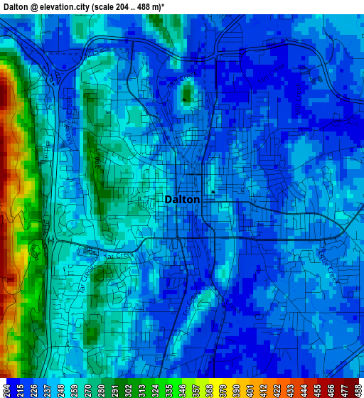
Below is the Elevation map of Dalton, which displays elevation range with different colors. Scale of the first map is from 204 to 488 m (669 to 1601 ft) with average elevation of 248.8 meters (=816 ft) [note 1]
These maps also provides idea of topography and contour of this city, they are displayed at different zoom levels. More info about maps, scale and edge coordinates you can find below images.
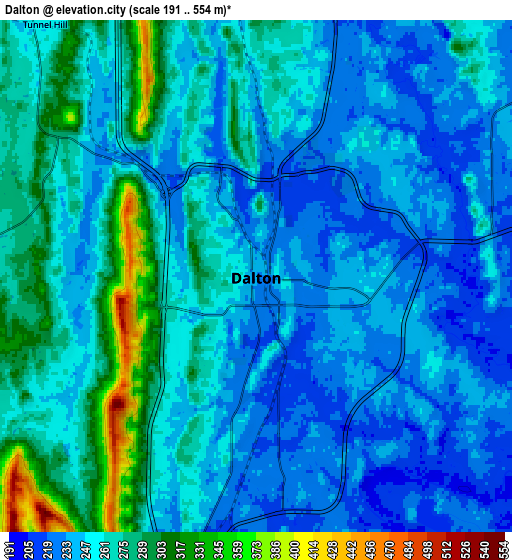
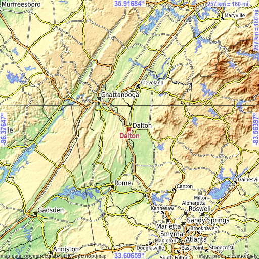
| \ | Map #1 | Map #2 | Topo.Map |
| Scale [m] | 204..488 m | 191..554 m | × |
| Scale [ft] | 669..1601 ft | 627..1818 ft | × |
| Average | 248.8 m = 816 ft | 255.7 m = 839 ft | × |
| Width | 8.03 km = 5 mi | 16.06 km = 10 mi | 256.9 km = 159.6 mi |
| Height | 8.03 km = 5 mi | 16.06 km = 10 mi | 256.9 km = 159.6 mi |
| ↑Max Latitude | 34.805891° | 34.841966° | 35.91684° |
| Latitude at center | 34.7698° | 34.7698° | 34.7698° |
| ↓Min Latitude | 34.733693° | 34.697571° | 33.60659° |
| ← Min Longitude | -85.014165° | -85.058111° | -86.37647° |
| Longitude center | -84.97022° | -84.97022° | -84.97022° |
| →Max Longitude | -84.926275° | -84.882329° | -83.56397° |
Nearby cities:
Cities around Dalton sort by population:
• Calhoun elevation 207 m
29.8 km,  176°
176°
• East Brainerd 226 m
30 km,  326°
326°
• Collegedale 238 m
32.3 km,  346°
346°
• Fort Oglethorpe 222 m
32.9 km,  307°
307°
• LaFayette 249 m
29.4 km,  255°
255°
• Fairview 263 m
34.7 km,  304°
304°
• Chatsworth 227 m
18.3 km,  91°
91°
• Ringgold 232 m
20.6 km,  322°
322°
• Chickamauga 225 m
31.4 km,  291°
291°
• Apison 262 m
28.7 km, 350°
• Indian Springs 223 m
27.4 km, 319°
• Varnell 247 m
14.6 km,  358°
358°
Multilingual:
 En español:
Dalton elevación 232 m.
 En France:
Dalton élévation 232 m.


Sources and notes:
- [note 1] Map square and city borders are not equal. Map elevation data is calculated only from area inside that square.
- [src 1] Elevation data from geonames database provided with same terms of usage.
- [src 2] The elevation map of Dalton is generated using elevation data from NASA's 3 arcsec (90m) resolution SRTM data.
- [src 3] Base (background) map © OpenStreetMap contributors tiles are generated by Geofabrik and OpenTopoMap.
Copyright & License:
This Dalton Elevation Map is licensed under CC BY-SA. You may reuse any part from this page, if you give a proper credit by linking to this URL:
 More info on terms of use page.