East Brainerd elevation
East Brainerd (Tennessee, Hamilton County), United States elevation is 226 meters and East Brainerd elevation in feet is 741 ft above sea level [src 1]. East Brainerd is a populated place (feature code) with elevation that is 53 meters (174 ft) smaller than average city elevation in United States.
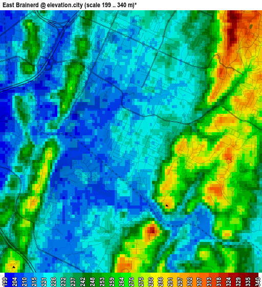
Below is the Elevation map of East Brainerd, which displays elevation range with different colors. Scale of the first map is from 199 to 340 m (653 to 1115 ft) with average elevation of 237.6 meters (=780 ft) [note 1]
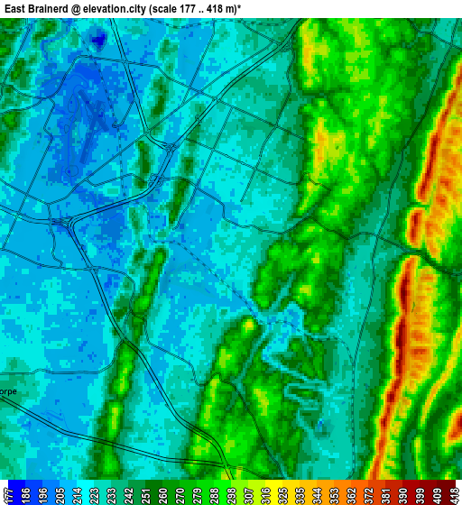
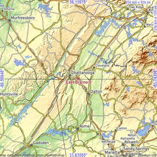
These maps also provides idea of topography and contour of this city, they are displayed at different zoom levels. More info about maps, scale and edge coordinates you can find below images.
| \ | Map #1 | Map #2 | Topo.Map |
| Scale [m] | 199..340 m | 177..418 m | × |
| Scale [ft] | 653..1115 ft | 581..1371 ft | × |
| Average | 237.6 m = 780 ft | 245.4 m = 805 ft | × |
| Width | 8.01 km = 5 mi | 16.01 km = 9.9 mi | 256.2 km = 159.2 mi |
| Height | 8.01 km = 5 mi | 16.01 km = 9.9 mi | 256.2 km = 159.2 mi |
| ↑Max Latitude | 35.031902° | 35.067878° | 36.13975° |
| Latitude at center | 34.99591° | 34.99591° | 34.99591° |
| ↓Min Latitude | 34.959902° | 34.923879° | 33.83585° |
| ← Min Longitude | -85.194175° | -85.238121° | -86.55648° |
| Longitude center | -85.15023° | -85.15023° | -85.15023° |
| →Max Longitude | -85.106285° | -85.062339° | -83.74398° |
Nearby cities:
Cities around East Brainerd sort by population:
• Chattanooga elevation 208 m
15.5 km,  290°
290°
• East Chattanooga 208 m
11.9 km,  310°
310°
• East Ridge 243 m
9.5 km,  282°
282°
• Collegedale 238 m
11.1 km,  55°
55°
• Fort Oglethorpe 222 m
11 km,  241°
241°
• Harrison 230 m
13.1 km,  4°
4°
• Fairview 263 m
13.4 km,  245°
245°
• Lakeview 236 m
10.1 km,  259°
259°
• Rossville 214 m
12.5 km, 263°
• Ringgold 232 m
9.7 km,  157°
157°
• Apison 262 m
11.9 km,  74°
74°
• Indian Springs 223 m
4.4 km,  196°
196°
Multilingual:
 En español:
East Brainerd elevación 226 m.
 En France:
East Brainerd élévation 226 m.
 Auf Deutsch:
East Brainerd höhe über dem Meeresspiegel ist 226 m.

Sources and notes:
- [note 1] Map square and city borders are not equal. Map elevation data is calculated only from area inside that square.
- [src 1] Elevation data from geonames database provided with same terms of usage.
- [src 2] The elevation map of East Brainerd is generated using elevation data from NASA's 3 arcsec (90m) resolution SRTM data.
- [src 3] Base (background) map © OpenStreetMap contributors tiles are generated by Geofabrik and OpenTopoMap.
Copyright & License:
This East Brainerd Elevation Map is licensed under CC BY-SA. You may reuse any part from this page, if you give a proper credit by linking to this URL:
 More info on terms of use page.