Wahneta elevation
Wahneta (Florida, Polk County), United States elevation is 45 meters and Wahneta elevation in feet is 148 ft above sea level [src 1]. Wahneta is a populated place (feature code) with elevation that is 234 meters (768 ft) smaller than average city elevation in United States.
Below is the Elevation map of Wahneta, which displays elevation range with different colors. Scale of the first map is from 27 to 65 m (89 to 213 ft) with average elevation of 41.9 meters (=137 ft) [note 1]
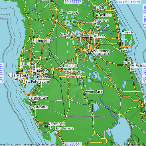
These maps also provides idea of topography and contour of this city, they are displayed at different zoom levels. More info about maps, scale and edge coordinates you can find below images.
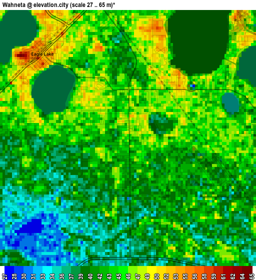
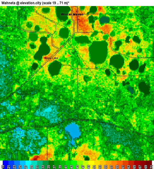
| \ | Map #1 | Map #2 | Topo.Map |
| Scale [m] | 27..65 m | 19..71 m | × |
| Scale [ft] | 89..213 ft | 62..233 ft | × |
| Average | 41.9 m = 137 ft | 41.4 m = 136 ft | × |
| Width | 8.63 km = 5.4 mi | 17.26 km = 10.7 mi | 276.2 km = 171.6 mi |
| Height | 8.63 km = 5.4 mi | 17.26 km = 10.7 mi | 276.2 km = 171.6 mi |
| ↑Max Latitude | 27.991611° | 28.030409° | 29.18777° |
| Latitude at center | 27.9528° | 27.9528° | 27.9528° |
| ↓Min Latitude | 27.913975° | 27.875135° | 26.70354° |
| ← Min Longitude | -81.770965° | -81.814911° | -83.13327° |
| Longitude center | -81.72702° | -81.72702° | -81.72702° |
| →Max Longitude | -81.683075° | -81.639129° | -80.32077° |
Nearby cities:
Cities around Wahneta sort by population:
• Winter Haven elevation 54 m
7.7 km,  355°
355°
• Bartow 46 m
13 km,  241°
241°
• Lake Wales 48 m
15 km,  112°
112°
• Auburndale 53 m
13.9 km,  334°
334°
• Highland City 39 m
14.9 km,  275°
275°
• Cypress Gardens 55 m
5.8 km,  38°
38°
• Inwood 50 m
10.1 km,  338°
338°
• Jan-Phyl Village 49 m
8.2 km, 327°
• Alturas 55 m
9.1 km,  172°
172°
• Dundee 52 m
13.1 km,  53°
53°
• Eagle Lake 53 m
4.1 km,  314°
314°
• Lake Hamilton 49 m
14.1 km, 43°
Multilingual:
 En español:
Wahneta elevación 45 m.
 En France:
Wahneta élévation 45 m.


Sources and notes:
- [note 1] Map square and city borders are not equal. Map elevation data is calculated only from area inside that square.
- [src 1] Elevation data from geonames database provided with same terms of usage.
- [src 2] The elevation map of Wahneta is generated using elevation data from NASA's 3 arcsec (90m) resolution SRTM data.
- [src 3] Base (background) map © OpenStreetMap contributors tiles are generated by Geofabrik and OpenTopoMap.
Copyright & License:
This Wahneta Elevation Map is licensed under CC BY-SA. You may reuse any part from this page, if you give a proper credit by linking to this URL:
 More info on terms of use page.