Auburndale elevation
Auburndale (Florida, Polk County), United States elevation is 53 meters and Auburndale elevation in feet is 174 ft above sea level [src 1]. Auburndale is a populated place (feature code) with elevation that is 226 meters (741 ft) smaller than average city elevation in United States.
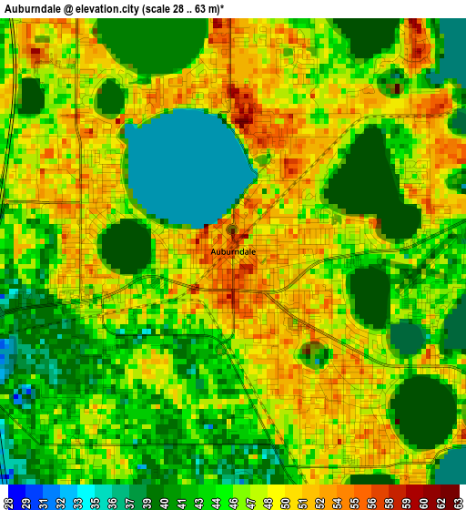
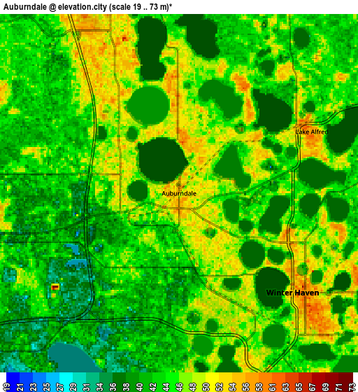
Below is the Elevation map of Auburndale, which displays elevation range with different colors. Scale of the first map is from 28 to 63 m (92 to 207 ft) with average elevation of 45.8 meters (=150 ft) [note 1]
These maps also provides idea of topography and contour of this city, they are displayed at different zoom levels. More info about maps, scale and edge coordinates you can find below images.
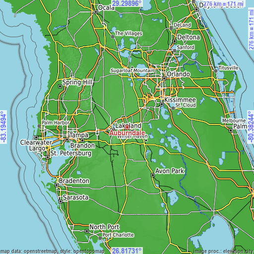
| \ | Map #1 | Map #2 | Topo.Map |
| Scale [m] | 28..63 m | 19..73 m | × |
| Scale [ft] | 92..207 ft | 62..240 ft | × |
| Average | 45.8 m = 150 ft | 44.1 m = 145 ft | × |
| Width | 8.62 km = 5.4 mi | 17.25 km = 10.7 mi | 275.9 km = 171.4 mi |
| Height | 8.62 km = 5.4 mi | 17.25 km = 10.7 mi | 275.9 km = 171.4 mi |
| ↑Max Latitude | 28.104071° | 28.142828° | 29.29896° |
| Latitude at center | 28.0653° | 28.0653° | 28.0653° |
| ↓Min Latitude | 28.026515° | 27.987716° | 26.81731° |
| ← Min Longitude | -81.832635° | -81.876581° | -83.19494° |
| Longitude center | -81.78869° | -81.78869° | -81.78869° |
| →Max Longitude | -81.744745° | -81.700799° | -80.38244° |
Nearby cities:
Cities around Auburndale sort by population:
• Winter Haven elevation 54 m
7.3 km,  131°
131°
• Highland City 39 m
14.2 km,  218°
218°
• Cypress Gardens 55 m
12.5 km, 129°
• Inwood 50 m
3.9 km,  143°
143°
• Combee Settlement 50 m
11.5 km,  266°
266°
• Jan-Phyl Village 49 m
5.9 km,  163°
163°
• Fussels Corner 37 m
7.2 km,  260°
260°
• Crystal Lake 49 m
12.2 km,  254°
254°
• Lake Alfred 57 m
7.1 km,  65°
65°
• Wahneta 45 m
13.9 km,  154°
154°
• Eagle Lake 53 m
10.2 km, 161°
• Polk City 56 m
13.5 km,  345°
345°
Multilingual:
 En español:
Auburndale elevación 53 m.
 En France:
Auburndale élévation 53 m.
 Auf Deutsch:
Auburndale höhe über dem Meeresspiegel ist 53 m.

Sources and notes:
- [note 1] Map square and city borders are not equal. Map elevation data is calculated only from area inside that square.
- [src 1] Elevation data from geonames database provided with same terms of usage.
- [src 2] The elevation map of Auburndale is generated using elevation data from NASA's 3 arcsec (90m) resolution SRTM data.
- [src 3] Base (background) map © OpenStreetMap contributors tiles are generated by Geofabrik and OpenTopoMap.
Copyright & License:
This Auburndale Elevation Map is licensed under CC BY-SA. You may reuse any part from this page, if you give a proper credit by linking to this URL:
 More info on terms of use page.