Malone elevation
Malone (Florida, Jackson County), United States elevation is 47 meters and Malone elevation in feet is 154 ft above sea level [src 1]. Malone is a populated place (feature code) with elevation that is 232 meters (761 ft) smaller than average city elevation in United States.
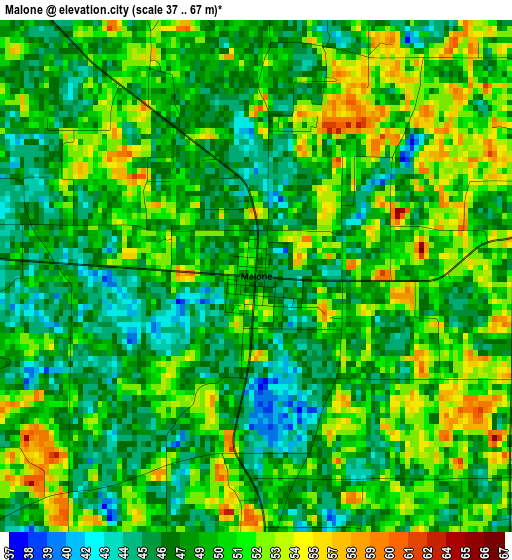
Below is the Elevation map of Malone, which displays elevation range with different colors. Scale of the first map is from 37 to 67 m (121 to 220 ft) with average elevation of 49.2 meters (=161 ft) [note 1]
These maps also provides idea of topography and contour of this city, they are displayed at different zoom levels. More info about maps, scale and edge coordinates you can find below images.

| \ | Map #1 | Topo.Map |
| Scale [m] | 37..67 m | × |
| Scale [ft] | 121..220 ft | × |
| Average | 49.2 m = 161 ft | × |
| Width | 8.38 km = 5.2 mi | 268.2 km = 166.7 mi |
| Height | 8.38 km = 5.2 mi | 268.2 km = 166.7 mi |
| ↑Max Latitude | 30.995368° | 32.15595° |
| Latitude at center | 30.95769° | 30.95769° |
| ↓Min Latitude | 30.919997° | 29.74421° |
| ← Min Longitude | -85.206095° | -86.5684° |
| Longitude center | -85.16215° | -85.16215° |
| →Max Longitude | -85.118205° | -83.7559° |
Nearby cities:
Cities around Malone sort by population:
• Dothan elevation 102 m
36.7 km,  323°
323°
• Marianna 55 m
21.3 km,  196°
196°
• Donalsonville 51 m
28.5 km,  71°
71°
• Taylor 103 m
37.2 km,  308°
308°
• Graceville 52 m
33.8 km,  269°
269°
• Ashford 79 m
26 km,  344°
344°
• Cowarts 104 m
30.2 km,  333°
333°
• Sneads 46 m
35.8 km,  140°
140°
• Rehobeth 80 m
33.2 km,  303°
303°
• Malvern 88 m
39.5 km, 300°
• Webb 88 m
35.3 km, 342°
• Cottonwood 56 m
17 km, 306°
Multilingual:
 En español:
Malone elevación 47 m.
 En France:
Malone élévation 47 m.


Sources and notes:
- [note 1] Map square and city borders are not equal. Map elevation data is calculated only from area inside that square.
- [src 1] Elevation data from geonames database provided with same terms of usage.
- [src 2] The elevation map of Malone is generated using elevation data from NASA's 3 arcsec (90m) resolution SRTM data.
- [src 3] Base (background) map © OpenStreetMap contributors tiles are generated by Geofabrik and OpenTopoMap.
Copyright & License:
This Malone Elevation Map is licensed under CC BY-SA. You may reuse any part from this page, if you give a proper credit by linking to this URL:
 More info on terms of use page.