Shelby elevation
Shelby (Alabama, Shelby County), United States elevation is 152 meters and Shelby elevation in feet is 499 ft above sea level [src 1]. Shelby is a populated place (feature code) with elevation that is 127 meters (417 ft) smaller than average city elevation in United States.
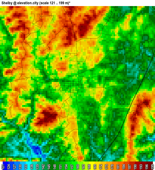
Below is the Elevation map of Shelby, which displays elevation range with different colors. Scale of the first map is from 121 to 199 m (397 to 653 ft) with average elevation of 160.5 meters (=527 ft) [note 1]
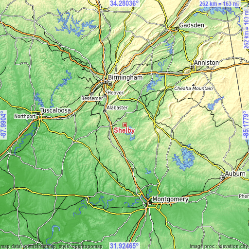
These maps also provides idea of topography and contour of this city, they are displayed at different zoom levels. More info about maps, scale and edge coordinates you can find below images.
| \ | Map #1 | Topo.Map |
| Scale [m] | 121..199 m | × |
| Scale [ft] | 397..653 ft | × |
| Average | 160.5 m = 527 ft | × |
| Width | 8.19 km = 5.1 mi | 261.9 km = 162.7 mi |
| Height | 8.19 km = 5.1 mi | 261.9 km = 162.7 mi |
| ↑Max Latitude | 33.147202° | 34.28036° |
| Latitude at center | 33.1104° | 33.1104° |
| ↓Min Latitude | 33.073583° | 31.92465° |
| ← Min Longitude | -86.628095° | -87.9904° |
| Longitude center | -86.58415° | -86.58415° |
| →Max Longitude | -86.540205° | -85.1779° |
Nearby cities:
Cities around Shelby sort by population:
• Alabaster elevation 145 m
26.2 km,  304°
304°
• Pelham 150 m
28.7 km,  312°
312°
• Calera 156 m
15.8 km,  266°
266°
• Chelsea 157 m
25.9 km,  350°
350°
• Montevallo 125 m
26.1 km, 267°
• Childersburg 130 m
28.3 km,  48°
48°
• Columbiana 167 m
7.8 km,  344°
344°
• Jemison 219 m
22.6 km,  222°
222°
• Thorsby 210 m
24.9 km,  209°
209°
• Wilsonville 131 m
16.7 km,  34°
34°
• Westover 150 m
27 km,  9°
9°
• Fayetteville 134 m
17.1 km,  76°
76°
Multilingual:
 En español:
Shelby elevación 152 m.
 En France:
Shelby élévation 152 m.


Sources and notes:
- [note 1] Map square and city borders are not equal. Map elevation data is calculated only from area inside that square.
- [src 1] Elevation data from geonames database provided with same terms of usage.
- [src 2] The elevation map of Shelby is generated using elevation data from NASA's 3 arcsec (90m) resolution SRTM data.
- [src 3] Base (background) map © OpenStreetMap contributors tiles are generated by Geofabrik and OpenTopoMap.
Copyright & License:
This Shelby Elevation Map is licensed under CC BY-SA. You may reuse any part from this page, if you give a proper credit by linking to this URL:
 More info on terms of use page.